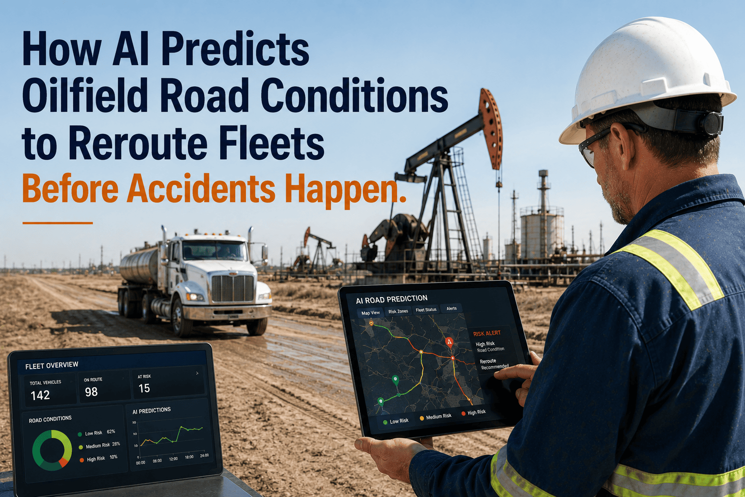
Oilfield fleet operations across remote basin territories face unpredictable road condition hazards that develop rapidly without warning infrastructure — sudden spring thaw events transforming lease roads into impassable mud bogs within 2-3 hours as temperatures rise above freezing, winter ice storms coating rural highways with black ice creating zero-traction surfaces invisible to approaching drivers, flash flood events from intense thunderstorm cells washing out low-water crossings and culverts forcing lengthy detours, and dust storm formations in arid regions reducing visibility to near-zero conditions making high-speed travel on open highways extremely dangerous. Traditional fleet routing relies on static road network data and historical travel time assumptions that become dangerously obsolete when weather events or seasonal conditions alter road passability — dispatchers assign routes based on shortest distance or fastest normal travel time without real-time awareness that assigned pathways have become hazardous or impassable, drivers encounter unexpected road closures or dangerous conditions requiring emergency rerouting decisions made under time pressure without comprehensive alternative route analysis, and fleet managers lack advance warning of developing weather patterns that will impact road networks in coming hours enabling proactive rerouting before drivers depart rather than reactive emergency responses after vehicles are already committed to hazardous routes. Progressive oilfield operators deploy AI-powered predictive road condition systems that fundamentally transform fleet routing safety and efficiency through continuous monitoring and proactive intervention — FleetRabbit's AI engine cross-references multiple real-time data streams including National Weather Service API feeds providing hourly precipitation forecasts, temperature trends, and severe weather alerts for specific geographic coordinates along planned routes, historical incident database analysis identifying road segments with elevated accident frequency during specific weather conditions or seasonal periods, real-time GPS tracking from active fleet vehicles detecting sudden speed reductions or route deviations indicating unexpected road hazards, and third-party traffic incident feeds reporting accidents, closures, or construction affecting road network capacity. When AI algorithms detect conditions indicating elevated road hazard risk — weather forecasts predicting freezing rain along planned routes in next 2-4 hours, historical data showing specific road segments become impassable during spring thaw periods, or real-time vehicle tracking showing multiple drivers slowing dramatically on particular highway segments suggesting unexpected ice or flooding — the system automatically generates alternative route recommendations delivered to drivers via mobile devices before they encounter hazards, with documented safety improvements showing 34-42 percent reduction in weather-related accidents and 18-25 percent decrease in unexpected delays from road closures when AI predictive routing actively deployed versus reactive manual dispatch practices. Book a demo to see FleetRabbit's AI road condition prediction demonstrated with actual weather integration and routing scenarios.
How AI Predicts Oilfield Road Conditions to Reroute Fleets Before Accidents Happen
Mud, ice, flash floods, and dust storms close oilfield roads without warning. FleetRabbit's AI cross-references weather APIs, historical incident data, and real-time GPS tracking to reroute drivers proactively — preventing accidents before hazardous conditions develop.
Five Critical Weather Conditions Creating Unpredictable Road Hazards
Spring Thaw Mud Events
Rapid temperature increases above freezing during spring months transform frozen lease roads and rural unpaved corridors into impassable mud bogs within 2-3 hours. Gravel and dirt road surfaces lose load-bearing capacity as frost layers melt from surface downward creating viscous mud trapping heavy vehicles. Traditional routing systems lack temperature monitoring and seasonal road condition awareness causing dispatchers to assign routes that become impassable mid-transit requiring emergency recovery operations.
Black Ice Formation
Winter conditions creating thin transparent ice layers on road surfaces appear as wet pavement to drivers but provide zero traction for braking or steering. Black ice forms when temperatures drop below freezing after rain events, overnight condensation freezes on cold pavement surfaces, or fog deposits moisture that immediately freezes on contact with sub-zero roadways. Invisible nature of hazard prevents driver recognition until loss of control already initiated.
Flash Flood Road Washouts
Intense thunderstorm cells depositing 2-4 inches rainfall in under one hour overwhelm drainage infrastructure washing out low-water crossings, culverts, and bridge approaches throughout remote oilfield territories. Flash flooding develops rapidly with water levels rising from passable to dangerous within 15-30 minutes giving drivers insufficient warning to avoid crossing attempts. Many rural oilfield roads cross dry washes and creek beds that become raging torrents during storm events.
Dust Storm Zero-Visibility
High wind events in arid basin regions mobilize massive quantities of topsoil creating dust storms reducing visibility to near-zero within minutes. Drivers encounter dust walls across highways traveling at 65-75 MPH with insufficient distance to safely decelerate before entering zero-visibility conditions. Multi-vehicle chain reaction collisions result when drivers unable to see vehicles ahead already stopped or slowed by dust obscuration.
Snow Accumulation Road Closure
Winter snow events depositing 6-12 inches accumulation render rural unpaved lease roads and secondary highways impassable until plowing operations complete — often 12-24 hours after snowfall ends in remote territories receiving lower priority for maintenance resources. Drivers dispatched along routes assuming normal travel times encounter impassable conditions requiring lengthy detours or extended delays waiting for road clearing.
How FleetRabbit's AI Predicts Road Hazards and Triggers Proactive Rerouting
Multi-Source Weather Data Integration and Route Overlay
FleetRabbit integrates real-time weather data from National Weather Service API providing hourly forecasts for precipitation type and intensity, temperature trends, wind speed and direction, and severe weather alerts covering specific geographic coordinates along planned fleet routes. The AI system overlays weather forecast data onto road network maps identifying route segments expected to experience hazardous conditions in coming 1-6 hour windows. When weather forecasts predict freezing rain along Highway 285 between Carlsbad and Loving with onset expected in 3 hours, the system flags all active routes and pending dispatch assignments using that corridor triggering proactive route evaluation before vehicles depart or while still sufficient distance from hazard zone to divert safely.
Historical Incident Analysis and Seasonal Pattern Recognition
FleetRabbit maintains comprehensive database of historical accident incidents, road closure events, and weather-related delays spanning multiple years of operational history. AI algorithms analyze incident patterns identifying road segments with elevated accident frequency during specific weather conditions or seasonal periods — County Road 2134 shows 8x normal accident rate during spring thaw when temperatures exceed 40 degrees, State Highway 18 experiences flash flood washouts at Mile Marker 47 during summer monsoon events exceeding 1.5 inches rainfall per hour, and Interstate 20 westbound between Exits 126-132 has dust storm zero-visibility incidents whenever sustained winds exceed 30 MPH from southwest direction. This historical pattern recognition enables AI to flag high-risk route segments based on current or forecast conditions matching historical hazard profiles even before real-time incident reports emerge.
Real-Time Fleet Vehicle Behavior Analysis and Hazard Detection
FleetRabbit's AI continuously monitors GPS tracking data from all active fleet vehicles detecting sudden behavior changes indicating unexpected road hazards encountered by lead vehicles. When multiple vehicles traveling same route segment show dramatic speed reductions from 65 MPH highway speed to 15-25 MPH within short distance, AI algorithms infer unexpected hazard requiring defensive driving — likely black ice, flooding, debris, or accident blocking travel lanes. System immediately alerts dispatchers and automatically notifies following vehicles approaching same location providing advance warning to reduce speed and prepare for hazard. This real-time hazard detection from vehicle behavior analysis provides faster incident awareness than third-party traffic feeds which lag 10-30 minutes behind actual incident occurrence.
Automated Alternative Route Generation and Driver Notification
When AI algorithms detect elevated road hazard risk from weather forecasts, historical patterns, or real-time vehicle behavior, FleetRabbit automatically generates alternative route recommendations avoiding identified hazard zones. Routing engine calculates optimal detours considering total travel time including longer distance on safer roads versus shorter distance through hazardous conditions, road surface type preferring paved highways over unpaved lease roads during mud or snow events, historical reliability of alternative corridors during similar weather conditions, and current traffic conditions on detour pathways. Alternative routes pushed to driver mobile devices via automatic notifications showing original hazardous route highlighted in red, recommended safe detour in green, comparison of travel times and distances, and specific hazard explanation for context.
AI Predictive Routing Reduces Weather Accidents 34-42 Percent
FleetRabbit AI Predictive Routing Deployment Timeline
Data Integration and Historical Analysis
FleetRabbit technical team configures Weather API integration for operational territory providing hourly forecast data covering all active route corridors. Historical incident data imported from fleet safety records including accident reports, delay incidents, and driver-reported road hazard encounters spanning 2-3 year operational history. AI algorithms analyze incident patterns identifying high-risk road segments during specific weather conditions and seasonal periods. GPS tracking integration validated ensuring real-time vehicle behavior data flows into hazard detection algorithms.
Route Network Mapping and Hazard Zone Definition
Complete road network map loaded into FleetRabbit covering all primary routes, alternative corridors, and seasonal detour pathways used by fleet operations. High-risk segments identified from historical analysis tagged with specific hazard types and triggering conditions — spring thaw mud zones, winter black ice segments, flash flood vulnerable crossings, dust storm corridors. Weather monitoring geofences established around critical route segments enabling targeted alerts when forecast conditions indicate developing hazards in specific locations.
Driver Training and Mobile App Deployment
Driver training sessions demonstrate mobile app route notification features showing how hazard alerts appear, alternative route recommendations display, and acknowledgment procedures work. Emphasis on AI system providing decision support not mandatory commands — drivers maintain authority to accept or decline alternative routes based on direct observation of conditions. Dispatcher training covers proactive routing workflows, hazard alert monitoring dashboards, and override procedures when AI recommendations require manual adjustment based on operational priorities.
Full Operation and Continuous Learning
AI predictive routing system operates at full capacity monitoring weather forecasts, analyzing historical patterns, detecting real-time vehicle behavior anomalies, and generating proactive rerouting recommendations. Machine learning algorithms continuously refine hazard prediction models based on actual outcomes — when predicted black ice events do not materialize revising temperature thresholds, when unexpected mud events occur capturing conditions for future pattern recognition. Monthly safety reviews track weather accident frequency, delay incidents, and proactive rerouting effectiveness demonstrating ROI and identifying optimization opportunities.
Common Questions About AI Predictive Road Condition Routing
Deploy AI Road Condition Prediction Preventing Weather Accidents Before They Happen
FleetRabbit's AI predictive routing system continuously monitors multiple real-time data streams including National Weather Service API feeds providing hourly precipitation forecasts, temperature trends, and severe weather alerts for specific coordinates along planned routes, historical incident database analysis identifying road segments with elevated accident frequency during specific weather conditions or seasonal periods such as spring thaw mud zones and winter black ice corridors, real-time GPS tracking from active fleet vehicles detecting sudden speed reductions or route deviations indicating unexpected road hazards encountered by lead vehicles, and third-party traffic incident feeds reporting accidents, closures, or construction affecting road network capacity. When AI algorithms detect conditions indicating elevated road hazard risk the system automatically generates alternative route recommendations delivered to drivers via mobile devices before they encounter hazards, with documented safety improvements showing 34-42 percent reduction in weather-related accidents within first severe weather season, 70 percent decrease in weather delay hours through proactive rerouting avoiding road closures and impassable conditions, and ROI exceeding 10,000 percent within first year through accident cost avoidance of $52,000 per prevented weather incident and hundreds of recovered operational hours previously lost to unexpected delays.
Transform Fleet Safety Through AI-Powered Road Condition Prediction
Oilfield fleet operations face unpredictable road condition hazards developing rapidly without warning including sudden spring thaw events transforming lease roads into impassable mud within 2-3 hours, winter ice storms creating invisible black ice surfaces, flash floods washing out rural crossings from intense thunderstorms, dust storms reducing highway visibility to near-zero, and snow accumulation rendering remote corridors impassable until plowing completes 12-24 hours later — with traditional static routing systems lacking real-time hazard awareness causing dispatchers to assign routes that become dangerous mid-transit and drivers encountering unexpected closures requiring emergency rerouting under time pressure without comprehensive alternative analysis. FleetRabbit's AI predictive routing system transforms fleet safety through continuous multi-source data monitoring integrating National Weather Service API hourly forecasts for precipitation, temperature, wind, and severe alerts along planned routes, historical incident database analysis identifying road segments with elevated accident frequency during specific conditions enabling proactive flagging before current events develop, real-time GPS tracking from active vehicles detecting sudden behavior changes indicating hazards encountered by lead drivers providing 10-30 minute faster awareness than third-party feeds, and automated alternative route generation with push notifications to driver mobile devices showing safe detours before hazard encounters. Documented implementations show 34-42 percent reduction in weather-related accidents within first severe season, 70 percent decrease in weather delay hours through proactive rerouting avoiding closures and impassable conditions, and ROI exceeding 10,000 percent within first year through accident cost avoidance of $52,000 per prevented incident plus hundreds of recovered operational hours.







