GPS Fleet Tracking for Oil & Gas Operations

oil-gas-fleet-gps-tracking

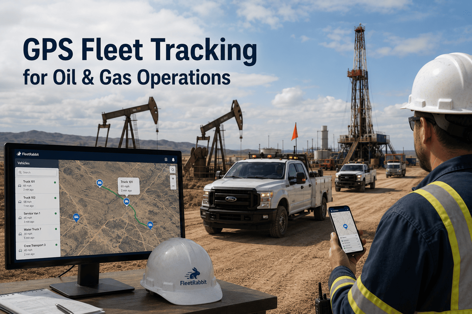
Oil and gas fleets operating across remote basins, lease roads, and wellsite locations need reliable visibility into vehicle location without relying on spotty cellular coverage or complex hardware deployments. Fleet Rabbit provides real-time GPS tracking integrated with existing telematics systems, enabling dispatchers to monitor asset location, optimize routing around road conditions, and coordinate arrivals at well sites—without requiring new hardware or long-term contracts. Book a Demo to see Fleet Rabbit in action.

30–60 sec
Typical location update frequency via integrated telematics APIs
10–50 m
Geofencing accuracy depending on signal conditions and terrain
5–15%
Potential mileage reduction through route optimization insights
99%+
Location data retention with automated backup and audit logging
Remote Operations Need Reliable Location Visibility. Fleet Rabbit Delivers It Without Hardware Changes.
Fleet Rabbit connects to existing GPS telematics providers to capture vehicle location, movement history, and geofence events in a centralized dashboard—enabling coordinated dispatch and improved asset utilization without new hardware installation.

Location Visibility Challenges in Oil and Gas Fleet Operations

Before implementing GPS tracking solutions, it is important to understand where visibility gaps typically occur in oilfield fleets. Dispersed assets, variable signal coverage, and disconnected systems leave dispatch teams without timely location data—gaps that integrated tracking can help address.

Limited Visibility in Remote Operating Areas
Cellular coverage gaps on lease roads and basin locations can delay location updates. Without offline-capable tracking, dispatchers may lack current asset positions during critical coordination windows.
Inefficient Dispatch Without Real-Time Data
Static assignment processes do not account for vehicle proximity, traffic conditions, or wellsite schedule changes. Unnecessary travel time accumulates without dynamic routing support.
Geofencing Gaps at Wellsites and Facilities
Manual check-in processes at remote locations create delays and documentation gaps. Automated arrival/departure logging reduces administrative burden and improves scheduling accuracy.
Disconnected Systems Create Coordination Friction
When GPS data lives in a separate platform from maintenance, fuel, or compliance systems, teams spend time switching tools rather than acting on insights.

How Fleet Rabbit Supports GPS Tracking for Oil and Gas Fleets

Fleet Rabbit integrates with existing telematics providers to provide structured location data without requiring hardware replacement. Data is captured at source and presented in actionable formats for dispatch and operations teams. See a live demo focused on location tracking, geofencing, and dispatch coordination.

01
Multi-Provider Telematics Integration
Connects to Samsara, Geotab, Verizon Connect, and other providers via API. Consolidates location data from mixed fleets into a single dashboard without hardware changes.
02
Real-Time Location Monitoring
Displays vehicle positions with 30–60 second update frequency where signal permits. Includes movement history, speed tracking, and status indicators for dispatch coordination.
03
Custom Geofencing for Oilfield Locations
Create geofences around well sites, facilities, and restricted zones. Automated arrival/departure alerts support scheduling, billing, and compliance documentation.
04
Route History and Optimization Insights
Review completed routes against planned paths. Identify recurring inefficiencies such as unnecessary backtracking or suboptimal sequencing for future planning.
05
Offline-Capable Mobile Access
Mobile apps cache location data when cellular signal is unavailable, syncing automatically when connectivity resumes. Supports field teams operating in low-coverage areas.
06
Unified Dashboard with Maintenance and Compliance
View location data alongside maintenance status, fuel usage, and compliance records. Reduces tool-switching and supports coordinated decision-making.

Regulatory and Operational Support for Location Data

Fleet Rabbit supports documentation and workflow requirements for location-based operational and compliance needs commonly faced by oil and gas fleet operators.

FMCSA Location Recordkeeping
Automated logging of vehicle location data to support hours-of-service verification and audit requests with timestamped, exportable records.
Wellsite Access Documentation
Geofence-based arrival/departure logs support billing verification, safety check-in requirements, and contractor coordination at remote locations.
HAZMAT Route Compliance
Track vehicle movement against approved routes for regulated cargo. Alert on deviations and maintain documentation for regulatory submissions.
Asset Utilization Reporting
Generate reports on vehicle usage patterns, idle time by location, and asset availability to support operational planning and capital decisions.

Fleet Rabbit vs. Other GPS Tracking Platforms

A feature-level comparison across capabilities relevant to oil and gas location tracking. Competitor data sourced from publicly available documentation and third-party reviews as of 2024. Talk to a specialist for a side-by-side evaluation against your current tool.

Capability Fleet Rabbit Fleetio Verizon Connect Samsara Geotab
Pricing (per vehicle/month) $5 $4–$7 $20–$35 $27–$45 $22–$35
Hardware Required No No Yes (GO device) Yes (Gateway) Yes (GO device)
Real-Time GPS Tracking Yes (via API) Limited Yes Yes Yes
Custom Geofencing Yes Basic Yes Yes Yes (via Rules)
Offline Mobile Support Yes Limited No Limited Limited
Mixed Fleet Consolidation Yes No No No Limited
Free Tier Up to 3 vehicles No No No No
Contract Term Monthly Monthly Annual 1–3 year Annual

Deployment Approach for GPS Tracking Implementation

Fleet Rabbit follows a structured onboarding process designed for dispersed fleet operations—delivering initial location visibility within the first week and full feature activation within two weeks. No hardware installation required.


01
Asset and Provider Audit
Map vehicles and existing telematics sources

02
API Integration Setup
Connect telematics providers via secure API

03
Geofence Configuration
Define well sites, facilities, and zones

04
Team Training
Onboard dispatchers and field coordinators

05
Go-Live and Review
Activate tracking and schedule effectiveness review

Typical Timeline and Expected Outcomes

Every Fleet Rabbit engagement follows a defined onboarding sequence with measurable milestones. Results vary by fleet size, operating geography, and dispatch process maturity. Request the full onboarding scope document tailored to your fleet profile.

Days 1–3
Integration and Baseline
Connect existing telematics providers via secure API
Import historical location data for baseline route analysis
Configure initial geofences for key well sites and facilities
Days 4–10
Pilot Monitoring
Activate real-time tracking on highest-utilization vehicle segments
Review initial geofence alerts and route history with dispatch team
Identify quick-win opportunities such as recurring route inefficiencies
Days 11–14
Full Activation
Expand tracking to full fleet with all configured geofences
Enable automated arrival logging and compliance documentation
Schedule 30-day review to assess dispatch coordination improvements
REALISTIC EXPECTATIONS: MEASURABLE IMPROVEMENTS WITH CONSISTENT USE
Fleets that systematically apply location insights—such as adjusting dispatch based on real-time proximity, refining geofence boundaries, and reviewing route patterns—typically see coordination improvements within the first 30–60 days. Results depend on operational follow-through and baseline process maturity.
5–12%
Mileage reduction potential
10–20%
Dispatch time savings
8–15 hrs
Admin time saved monthly
Start Tracking Asset Location. Improve Dispatch Coordination in Two Weeks.
Fleet Rabbit's fixed-scope onboarding means no open timelines, no hardware installation, and no months of customization before you gain visibility. Deploy at $5/vehicle/month and begin monitoring within 72 hours.

Use Cases from Oil and Gas Fleet Deployments

These examples reflect common scenarios where Fleet Rabbit has supported location visibility efforts. Outcomes depend on fleet size, operating geography, and dispatch process maturity. Request additional details for the use case most relevant to your operations.

Use Case 01
Dispatch Coordination for Service Trucks — 40 Vehicles
A regional service fleet supporting wellsite operations had limited visibility into vehicle proximity when assigning urgent requests. Fleet Rabbit's real-time location dashboard enabled dispatchers to assign the nearest available unit, reducing response times and unnecessary travel.
8–10%
Mileage reduction
12%
Faster response
45 days
Review cycle
Use Case 02
Geofencing for Wellsite Access — 60 Haul Units
A water hauling operation needed automated documentation of vehicle arrivals and departures at remote well sites for billing and safety compliance. Fleet Rabbit's geofence alerts reduced manual check-in time and improved scheduling accuracy for subsequent loads.
95%+
Arrival logging accuracy
6 hrs/wk
Admin time saved
Ongoing
Monitoring
Use Case 03
Mixed Fleet Consolidation — 30+ Assets Across Providers
An operator managing vehicles with different telematics providers needed a single view for dispatch coordination. Fleet Rabbit's API integration consolidated location data from multiple sources into one dashboard, reducing tool-switching and improving situational awareness.
1 platform
Unified view
3 providers
Integrated
Real-time
Updates

What Fleet Teams Say About Fleet Rabbit

Fleet Rabbit gave us a single view of all our vehicles, even though they were on different tracking systems. Dispatchers can now see who is closest to a well site and assign jobs faster. The geofence alerts also help us document arrivals without calling drivers.
Dispatch Coordinator
Basin-Based Transportation Provider

Frequently Asked Questions

Does Fleet Rabbit require new hardware for GPS tracking?
No. Fleet Rabbit connects to existing telematics providers via API. Where gaps are identified during onboarding, targeted additions may be recommended—but full hardware replacement is not required.
Which telematics providers does Fleet Rabbit integrate with?
Natively integrates with Samsara, Verizon Connect, Geotab, Motive, and custom platforms via REST API. Integration scope is confirmed during the initial asset audit.
How does Fleet Rabbit handle location tracking in areas without cellular coverage?
Mobile apps cache location and event data when cellular signal is unavailable, syncing automatically when connectivity resumes. Telematics devices with satellite fallback continue transmitting through their native networks.
Can I create custom geofences for well sites and facilities?
Yes. Fleet Rabbit supports custom polygon and radius geofences. Alerts can be configured for arrival, departure, or dwell time thresholds, with exportable logs for billing or compliance.
How quickly is location data available after onboarding?
Baseline location data is available within 24–48 hours of API integration. Real-time updates begin flowing as vehicles operate. Meaningful route analysis typically requires 1–2 weeks of data.
What is the pricing for Fleet Rabbit GPS tracking?
Fleet Rabbit is priced at $5 per vehicle per month, billed monthly with no long-term contract. A free tier is available for up to 3 vehicles to evaluate functionality before scaling.
Track Assets. Coordinate Dispatch. Improve Visibility in Two Weeks.
Fleet Rabbit provides oil and gas fleet teams with real-time GPS tracking, custom geofencing, route analytics, and unified dispatch visibility—integrated with existing telematics in 5–7 working days, at $5/vehicle/month, with no new hardware required.
API integration with major telematics providers
Custom geofencing for well sites and facilities
Offline-capable mobile apps for remote operations
Unified dashboard with maintenance and compliance data

May 22, 2026 By Jason
All Posts
GPS Fleet Tracking for Oil & Gas Operations

oil-gas-fleet-gps-tracking

Oil and gas fleets operating across remote basins, lease roads, and wellsite locations need reliable visibility into vehicle location without relying on spotty cellular coverage or complex hardware deployments. Fleet Rabbit provides real-time GPS tracking integrated with existing telematics systems, enabling dispatchers to monitor asset location, optimize routing around road conditions, and coordinate arrivals at well sites—without requiring new hardware or long-term contracts. Book a Demo to see Fleet Rabbit in action.

30–60 sec
Typical location update frequency via integrated telematics APIs
10–50 m
Geofencing accuracy depending on signal conditions and terrain
5–15%
Potential mileage reduction through route optimization insights
99%+
Location data retention with automated backup and audit logging
Remote Operations Need Reliable Location Visibility. Fleet Rabbit Delivers It Without Hardware Changes.
Fleet Rabbit connects to existing GPS telematics providers to capture vehicle location, movement history, and geofence events in a centralized dashboard—enabling coordinated dispatch and improved asset utilization without new hardware installation.

Location Visibility Challenges in Oil and Gas Fleet Operations

Before implementing GPS tracking solutions, it is important to understand where visibility gaps typically occur in oilfield fleets. Dispersed assets, variable signal coverage, and disconnected systems leave dispatch teams without timely location data—gaps that integrated tracking can help address.

Limited Visibility in Remote Operating Areas
Cellular coverage gaps on lease roads and basin locations can delay location updates. Without offline-capable tracking, dispatchers may lack current asset positions during critical coordination windows.
Inefficient Dispatch Without Real-Time Data
Static assignment processes do not account for vehicle proximity, traffic conditions, or wellsite schedule changes. Unnecessary travel time accumulates without dynamic routing support.
Geofencing Gaps at Wellsites and Facilities
Manual check-in processes at remote locations create delays and documentation gaps. Automated arrival/departure logging reduces administrative burden and improves scheduling accuracy.
Disconnected Systems Create Coordination Friction
When GPS data lives in a separate platform from maintenance, fuel, or compliance systems, teams spend time switching tools rather than acting on insights.

How Fleet Rabbit Supports GPS Tracking for Oil and Gas Fleets

Fleet Rabbit integrates with existing telematics providers to provide structured location data without requiring hardware replacement. Data is captured at source and presented in actionable formats for dispatch and operations teams. See a live demo focused on location tracking, geofencing, and dispatch coordination.

01
Multi-Provider Telematics Integration
Connects to Samsara, Geotab, Verizon Connect, and other providers via API. Consolidates location data from mixed fleets into a single dashboard without hardware changes.
02
Real-Time Location Monitoring
Displays vehicle positions with 30–60 second update frequency where signal permits. Includes movement history, speed tracking, and status indicators for dispatch coordination.
03
Custom Geofencing for Oilfield Locations
Create geofences around well sites, facilities, and restricted zones. Automated arrival/departure alerts support scheduling, billing, and compliance documentation.
04
Route History and Optimization Insights
Review completed routes against planned paths. Identify recurring inefficiencies such as unnecessary backtracking or suboptimal sequencing for future planning.
05
Offline-Capable Mobile Access
Mobile apps cache location data when cellular signal is unavailable, syncing automatically when connectivity resumes. Supports field teams operating in low-coverage areas.
06
Unified Dashboard with Maintenance and Compliance
View location data alongside maintenance status, fuel usage, and compliance records. Reduces tool-switching and supports coordinated decision-making.

Regulatory and Operational Support for Location Data

Fleet Rabbit supports documentation and workflow requirements for location-based operational and compliance needs commonly faced by oil and gas fleet operators.

FMCSA Location Recordkeeping
Automated logging of vehicle location data to support hours-of-service verification and audit requests with timestamped, exportable records.
Wellsite Access Documentation
Geofence-based arrival/departure logs support billing verification, safety check-in requirements, and contractor coordination at remote locations.
HAZMAT Route Compliance
Track vehicle movement against approved routes for regulated cargo. Alert on deviations and maintain documentation for regulatory submissions.
Asset Utilization Reporting
Generate reports on vehicle usage patterns, idle time by location, and asset availability to support operational planning and capital decisions.

Fleet Rabbit vs. Other GPS Tracking Platforms

A feature-level comparison across capabilities relevant to oil and gas location tracking. Competitor data sourced from publicly available documentation and third-party reviews as of 2024. Talk to a specialist for a side-by-side evaluation against your current tool.

Capability Fleet Rabbit Fleetio Verizon Connect Samsara Geotab
Pricing (per vehicle/month) $5 $4–$7 $20–$35 $27–$45 $22–$35
Hardware Required No No Yes (GO device) Yes (Gateway) Yes (GO device)
Real-Time GPS Tracking Yes (via API) Limited Yes Yes Yes
Custom Geofencing Yes Basic Yes Yes Yes (via Rules)
Offline Mobile Support Yes Limited No Limited Limited
Mixed Fleet Consolidation Yes No No No Limited
Free Tier Up to 3 vehicles No No No No
Contract Term Monthly Monthly Annual 1–3 year Annual

Deployment Approach for GPS Tracking Implementation

Fleet Rabbit follows a structured onboarding process designed for dispersed fleet operations—delivering initial location visibility within the first week and full feature activation within two weeks. No hardware installation required.


01
Asset and Provider Audit
Map vehicles and existing telematics sources

02
API Integration Setup
Connect telematics providers via secure API

03
Geofence Configuration
Define well sites, facilities, and zones

04
Team Training
Onboard dispatchers and field coordinators

05
Go-Live and Review
Activate tracking and schedule effectiveness review

Typical Timeline and Expected Outcomes

Every Fleet Rabbit engagement follows a defined onboarding sequence with measurable milestones. Results vary by fleet size, operating geography, and dispatch process maturity. Request the full onboarding scope document tailored to your fleet profile.

Days 1–3
Integration and Baseline
Connect existing telematics providers via secure API
Import historical location data for baseline route analysis
Configure initial geofences for key well sites and facilities
Days 4–10
Pilot Monitoring
Activate real-time tracking on highest-utilization vehicle segments
Review initial geofence alerts and route history with dispatch team
Identify quick-win opportunities such as recurring route inefficiencies
Days 11–14
Full Activation
Expand tracking to full fleet with all configured geofences
Enable automated arrival logging and compliance documentation
Schedule 30-day review to assess dispatch coordination improvements
REALISTIC EXPECTATIONS: MEASURABLE IMPROVEMENTS WITH CONSISTENT USE
Fleets that systematically apply location insights—such as adjusting dispatch based on real-time proximity, refining geofence boundaries, and reviewing route patterns—typically see coordination improvements within the first 30–60 days. Results depend on operational follow-through and baseline process maturity.
5–12%
Mileage reduction potential
10–20%
Dispatch time savings
8–15 hrs
Admin time saved monthly
Start Tracking Asset Location. Improve Dispatch Coordination in Two Weeks.
Fleet Rabbit's fixed-scope onboarding means no open timelines, no hardware installation, and no months of customization before you gain visibility. Deploy at $5/vehicle/month and begin monitoring within 72 hours.

Use Cases from Oil and Gas Fleet Deployments

These examples reflect common scenarios where Fleet Rabbit has supported location visibility efforts. Outcomes depend on fleet size, operating geography, and dispatch process maturity. Request additional details for the use case most relevant to your operations.

Use Case 01
Dispatch Coordination for Service Trucks — 40 Vehicles
A regional service fleet supporting wellsite operations had limited visibility into vehicle proximity when assigning urgent requests. Fleet Rabbit's real-time location dashboard enabled dispatchers to assign the nearest available unit, reducing response times and unnecessary travel.
8–10%
Mileage reduction
12%
Faster response
45 days
Review cycle
Use Case 02
Geofencing for Wellsite Access — 60 Haul Units
A water hauling operation needed automated documentation of vehicle arrivals and departures at remote well sites for billing and safety compliance. Fleet Rabbit's geofence alerts reduced manual check-in time and improved scheduling accuracy for subsequent loads.
95%+
Arrival logging accuracy
6 hrs/wk
Admin time saved
Ongoing
Monitoring
Use Case 03
Mixed Fleet Consolidation — 30+ Assets Across Providers
An operator managing vehicles with different telematics providers needed a single view for dispatch coordination. Fleet Rabbit's API integration consolidated location data from multiple sources into one dashboard, reducing tool-switching and improving situational awareness.
1 platform
Unified view
3 providers
Integrated
Real-time
Updates

What Fleet Teams Say About Fleet Rabbit

Fleet Rabbit gave us a single view of all our vehicles, even though they were on different tracking systems. Dispatchers can now see who is closest to a well site and assign jobs faster. The geofence alerts also help us document arrivals without calling drivers.
Dispatch Coordinator
Basin-Based Transportation Provider

Frequently Asked Questions

Does Fleet Rabbit require new hardware for GPS tracking?
No. Fleet Rabbit connects to existing telematics providers via API. Where gaps are identified during onboarding, targeted additions may be recommended—but full hardware replacement is not required.
Which telematics providers does Fleet Rabbit integrate with?
Natively integrates with Samsara, Verizon Connect, Geotab, Motive, and custom platforms via REST API. Integration scope is confirmed during the initial asset audit.
How does Fleet Rabbit handle location tracking in areas without cellular coverage?
Mobile apps cache location and event data when cellular signal is unavailable, syncing automatically when connectivity resumes. Telematics devices with satellite fallback continue transmitting through their native networks.
Can I create custom geofences for well sites and facilities?
Yes. Fleet Rabbit supports custom polygon and radius geofences. Alerts can be configured for arrival, departure, or dwell time thresholds, with exportable logs for billing or compliance.
How quickly is location data available after onboarding?
Baseline location data is available within 24–48 hours of API integration. Real-time updates begin flowing as vehicles operate. Meaningful route analysis typically requires 1–2 weeks of data.
What is the pricing for Fleet Rabbit GPS tracking?
Fleet Rabbit is priced at $5 per vehicle per month, billed monthly with no long-term contract. A free tier is available for up to 3 vehicles to evaluate functionality before scaling.
Track Assets. Coordinate Dispatch. Improve Visibility in Two Weeks.
Fleet Rabbit provides oil and gas fleet teams with real-time GPS tracking, custom geofencing, route analytics, and unified dispatch visibility—integrated with existing telematics in 5–7 working days, at $5/vehicle/month, with no new hardware required.
API integration with major telematics providers
Custom geofencing for well sites and facilities
Offline-capable mobile apps for remote operations
Unified dashboard with maintenance and compliance data

May 22, 2026 By Jason
All Posts

Share This Story, Choose Your Platform!

Latest Posts

Scroll






