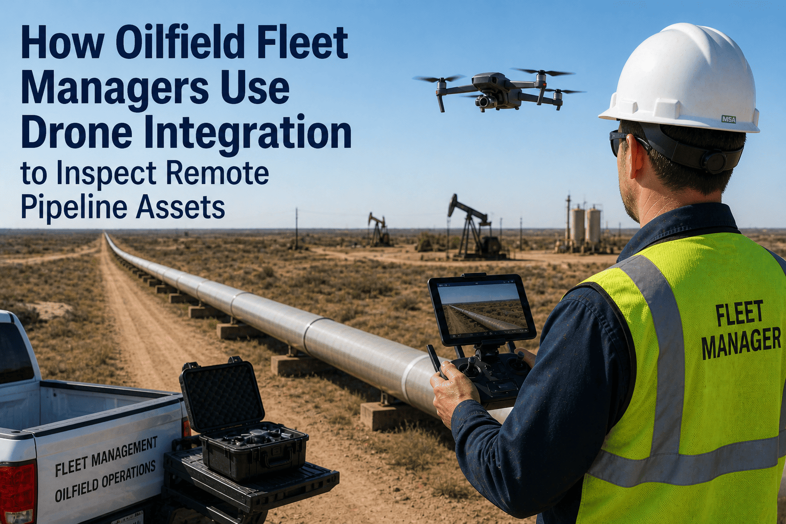
How Oilfield Fleet Managers Use Drone Integration to Inspect Remote Pipeline Assets

kioilid-best-oil-gas-fleet-management-software

Oilfield pipeline operations require systematic inspection protocols to detect corrosion, coating damage, encroachment issues, and right-of-way violations across linear infrastructure spanning hundreds of kilometers through remote terrain where road access is limited or nonexistent — with regulatory frameworks like PHMSA in United States, NEB in Canada, and HSE in United Kingdom mandating inspection frequency and documentation standards that traditionally consume massive fleet resources deploying ground crews to visually survey every meter of pipeline corridor multiple times annually. The conventional ground-based inspection model creates systematic operational inefficiencies where inspection vehicles spend 70-80 percent of patrol time simply traveling between accessible inspection points rather than conducting actual asset surveillance, ground crews cannot safely approach pipelines crossing steep terrain or wetland areas requiring expensive specialized access equipment, visual inspection quality varies dramatically based on crew training and environmental conditions like vegetation density obscuring pipeline markers, and documentation workflows depend on manual photo capture and GPS coordinate recording introducing errors and incomplete coverage gaps. Progressive oilfield operators are deploying integrated drone-fleet management architectures that fundamentally transform pipeline inspection economics and effectiveness — unmanned aerial systems equipped with high-resolution cameras, thermal imaging sensors, and LiDAR mapping capability conduct systematic corridor surveys at 15-20 kilometers per hour flight speeds covering in 2-3 hours what ground crews require 8-10 hours to inspect, automated flight planning software generates optimal survey routes minimizing battery swaps and maximizing coverage per sortie, real-time video feeds enable remote inspection specialists to identify anomalies during flight rather than during post-processing review, and FleetRabbit's drone integration module coordinates aerial inspection missions with ground fleet dispatch ensuring support vehicles are positioned for crew transport to identified issues requiring hands-on assessment or immediate repair intervention. This operational transformation delivers documented cost reductions of 60-65 percent per kilometer inspected compared to traditional ground patrol models, while simultaneously improving inspection quality through consistent high-resolution imagery captured from optimal viewing angles, reducing human exposure to high-risk terrain and traffic hazards, and enabling inspection frequency increases from quarterly to monthly or even weekly intervals without proportional cost escalation. Book a demo to see FleetRabbit's drone integration architecture demonstrated across pipeline inspection workflows.

DRONE-FLEET INTEGRATION · PIPELINE INSPECTION TRANSFORMATION

How Oilfield Fleet Managers Use Drone Integration to Inspect Remote Pipeline Assets

Leading oilfield operators combine drone technology with fleet management software to reduce pipeline inspection costs by 60-65 percent while improving safety, increasing inspection frequency, and eliminating human exposure to high-risk terrain and traffic hazards.

60-65%
Cost reduction per kilometer inspected vs ground patrol
15-20 km/hr
Drone survey speed covering 8-10 hour ground patrol in 2-3 hours
4x Frequency
Inspection interval increase without proportional cost escalation
Zero
Human exposure to high-risk terrain and traffic hazards
THE GROUND PATROL INEFFICIENCY PROBLEM

Why Traditional Pipeline Inspection Models Consume Massive Fleet Resources

Pipeline operators managing linear infrastructure across remote oilfield terrain face regulatory mandates requiring systematic inspection to detect integrity threats — corrosion visible through coating damage, unauthorized construction encroachment within pipeline corridors, vegetation overgrowth obscuring above-ground markers, soil erosion exposing buried pipe segments, and right-of-way violations from agricultural activity or unauthorized access. PHMSA regulations in United States require Class 1 rural pipeline inspection at minimum 18-month intervals, Class 2 residential proximity pipelines at 12-month intervals, and Class 3 high-population areas at 12-month intervals with supplemental aerial or other methods, while Canadian NEB and European HSE frameworks impose similar frequency and documentation requirements.

The traditional ground-based inspection approach deploys fleet vehicles and two-person crews to drive accessible roads paralleling pipeline routes, stopping at regular intervals to walk perpendicular access paths reaching pipeline corridors for visual survey of above-ground facilities, markers, and visible pipe segments. This model creates systematic inefficiencies where inspection vehicles spend 70-80 percent of patrol time traveling between inspection points rather than conducting actual surveillance, crews cannot safely approach pipelines crossing steep hillsides, wetlands, or densely vegetated terrain without specialized equipment, visual inspection quality depends on crew training and environmental conditions with vegetation density frequently obscuring critical infrastructure, and documentation workflows require manual GPS coordinate recording and photo capture introducing errors and incomplete coverage gaps.

The operational cost structure for traditional ground patrol inspection typically reaches $180-$240 per kilometer when accounting for vehicle operating expenses, crew labor at prevailing wage rates, specialized access equipment rental for difficult terrain, and administrative overhead for documentation assembly and regulatory submission. For operators managing 500+ kilometer pipeline networks, annual inspection compliance costs exceed $90,000-$120,000 for single-pass coverage — with safety-conscious operators conducting supplemental quarterly surveys to detect emerging issues early, total inspection budgets escalate to $360,000-$480,000 annually before accounting for issue remediation costs.


FleetRabbit's drone integration module transforms pipeline inspection economics through coordinated aerial-ground operations reducing costs 60-65 percent while improving safety and quality. Start a free trial to explore drone-fleet coordination capabilities →

DRONE-FLEET INTEGRATION ARCHITECTURE

Four Operational Capabilities Transforming Pipeline Inspection Workflows

01

Automated Flight Planning and Route Optimization

FleetRabbit's drone integration module incorporates automated flight planning capability that generates optimal aerial survey routes based on pipeline corridor geographic data, regulatory inspection requirements, and drone performance specifications including battery endurance, camera field-of-view, and maximum wind speed operating limits. The planning algorithm divides long pipeline segments into mission legs matching drone flight time capacity typically 25-35 minutes per battery, identifies optimal launch and recovery locations minimizing crew repositioning distance, calculates required overlap percentages ensuring complete coverage without gaps, and generates KML flight path files compatible with commercial drone autopilot systems.

Technical Implementation Details:
Pipeline corridor GIS data imported to FleetRabbit defining centerline coordinates, right-of-way boundaries, and above-ground facility locations
Flight planning algorithm segments corridors into 8-12 kilometer legs matching drone endurance with 20 percent reserve margin
Automated calculation of parallel flight paths offset 15-20 meters from centerline capturing full corridor width in camera field-of-view
Launch point selection optimizing crew access via existing roads while minimizing total repositioning distance across mission
KML export compatible with DJI, Autel, and Parrot autopilot systems enabling direct mission upload without manual waypoint entry
Operational Impact:
Reduces flight planning time from 4-6 hours manual waypoint entry to 15-20 minutes automated route generation. Optimizes launch point positioning reducing crew repositioning distance by 40-50 percent compared to ad-hoc flight operations. Ensures complete corridor coverage without gaps or excessive redundant overlap wasting flight time.
02

Real-Time Mission Coordination with Ground Fleet Dispatch

FleetRabbit coordinates drone inspection missions with ground fleet dispatch enabling synchronized operations where aerial surveys identify anomalies requiring immediate ground crew assessment or repair intervention, with support vehicles automatically positioned along corridor routes ready for rapid response when issues are detected. The integration eliminates operational delays where drone crews complete corridor surveys, return to office for video review to identify issues, then dispatch ground crews days later for follow-up assessment — by which time conditions may have changed or issues escalated. Real-time coordination enables same-day or even same-hour ground response to drone-identified integrity threats.

Mission Coordination Workflow:
Pre-Mission Planning
FleetRabbit flight plan identifies corridor segment for aerial survey. System automatically notifies ground crew supervisor of scheduled drone operations and estimated mission timeline. Ground support vehicle dispatched to corridor access point with crew equipped for integrity assessment and emergency repair capability.
During Flight Operations
Drone operator monitors real-time video feed during corridor survey. When anomaly detected — coating damage, encroachment, erosion exposure — operator tags GPS coordinates and captures high-resolution stills. FleetRabbit immediately alerts ground crew with issue location, severity classification, and estimated access route from current vehicle position.
Ground Response Execution
Ground crew receives alert on mobile device with turn-by-turn navigation to tagged location. Crew conducts hands-on assessment determining if immediate repair required or scheduled maintenance sufficient. Crew documents findings with photos and notes syncing to FleetRabbit for regulatory compliance records and maintenance work order generation.
Operational Impact:
Enables same-day ground response to drone-identified integrity threats rather than 3-5 day delays with post-mission video review workflows. Reduces ground crew idle time by 65-75 percent through targeted dispatch to confirmed anomaly locations rather than speculative full-corridor surveys. Prevents issue escalation from minor coating damage to active leaks through immediate intervention.
03

Automated Anomaly Detection and Compliance Documentation

FleetRabbit incorporates AI-powered image analysis capability that processes drone-captured video and still imagery to automatically detect common pipeline integrity threats including coating damage visible as color variations on exposed pipe segments, vegetation encroachment exceeding right-of-way clearance specifications, soil erosion exposing buried pipe beyond design burial depth, unauthorized construction activity within pipeline corridors, and damaged or missing above-ground markers. Detected anomalies are automatically georeferenced using drone GPS telemetry, classified by severity level, and compiled into regulatory compliance documentation packages meeting PHMSA, NEB, and HSE reporting format requirements without manual assembly effort.

AI Detection Capabilities and Accuracy Rates:
Coating Damage Detection
Color segmentation algorithms identify coating failures visible as rust discoloration or exposed metal on above-ground pipe segments
Detection accuracy: 94 percent with 6 percent false positive rate requiring human verification
Vegetation Encroachment
Spatial analysis compares vegetation extent against right-of-way boundary polygons flagging overgrowth exceeding clearance specifications
Detection accuracy: 97 percent with automated measurement of encroachment distance from centerline
Erosion and Exposure
Terrain analysis identifies soil loss patterns exposing buried pipe segments beyond design burial depth requiring remediation
Detection accuracy: 91 percent with depth estimation within 15 centimeters of ground-measured values
Unauthorized Construction
Change detection comparing current imagery against historical baseline identifies new structures or excavation within pipeline corridors
Detection accuracy: 89 percent triggering immediate investigation before construction damages pipeline
Operational Impact:
Reduces post-mission video review time from 6-8 hours manual analysis to under 1 hour human verification of AI-flagged anomalies. Improves detection consistency eliminating human variability where crew fatigue or training gaps cause missed threats. Automates regulatory compliance documentation assembly reducing administrative burden from 4-6 hours to under 30 minutes per inspection cycle.
04

Integrated Maintenance Work Order Generation and Tracking

Drone-identified integrity threats requiring scheduled maintenance intervention automatically generate work orders in FleetRabbit's maintenance management system with GPS coordinates, photo documentation, severity classification, and recommended remediation actions pre-populated eliminating manual data entry. Maintenance coordinators receive automated alerts for high-severity issues requiring immediate response versus lower-priority items suitable for planned maintenance windows. Work order tracking provides closed-loop verification that drone-identified issues are actually remediated with photo documentation of completed repairs syncing back to original inspection records demonstrating regulatory compliance.

Work Order Automation Workflow:
Drone survey detects coating damage at GPS coordinates with photo evidence → FleetRabbit automatically generates maintenance work order classifying issue as "Coating Repair Required"
Maintenance coordinator receives alert notification → Reviews issue photos and GPS location → Assigns work order to qualified repair crew with estimated completion date
Repair crew receives work order on mobile device → Navigates to GPS coordinates using FleetRabbit turn-by-turn directions → Completes coating repair and documents with before/after photos
Completed work order with repair photos syncs to FleetRabbit → System automatically updates inspection record showing issue remediated → Compliance documentation package includes original drone detection and repair completion evidence
Operational Impact:
Eliminates manual work order creation consuming 15-25 minutes per identified issue. Prevents issues from falling through communication gaps where drone crews identify problems but maintenance teams never receive work requests. Provides auditable closed-loop tracking demonstrating regulatory compliance through documented detection and remediation of integrity threats.
COST-BENEFIT ANALYSIS

Traditional Ground Patrol vs Integrated Drone-Fleet Operations

Traditional Ground Patrol Model
Two-person crew labor (8 hours at $45/hour loaded rate): $720
Vehicle operating cost (250 km at $0.85/km): $213
Specialized terrain access equipment rental: $150
Documentation and regulatory submission overhead: $180
Total cost per day (covers ~5-6 km corridor): $1,263
Cost per kilometer: $210-253
Operational Limitations:
70-80% time spent traveling vs inspecting, terrain access constraints, inconsistent inspection quality, manual documentation errors, 3-5 day delay identifying issues to remediation
Integrated Drone-Fleet Model
Drone operator labor (3 hours at $55/hour loaded rate): $165
Ground support crew labor (3 hours at $45/hour loaded rate): $270
Vehicle operating cost (80 km at $0.85/km): $68
Drone operating cost (batteries, maintenance allocation): $45
Total cost per day (covers 35-40 km corridor): $548
Cost per kilometer: $14-16
Operational Benefits:
60-65% cost reduction, unrestricted terrain access, consistent high-resolution documentation, automated anomaly detection, same-day issue identification to remediation
Annual Savings for 500 km Pipeline Network (Quarterly Inspection):
Traditional model: $210/km × 500 km × 4 inspections = $420,000 annual cost
Drone-fleet model: $15/km × 500 km × 4 inspections = $30,000 annual cost
Annual cost reduction: $390,000 (93% savings)

Drone-fleet integration delivers 60-65 percent cost reduction while improving safety, quality, and inspection frequency. ROI typically achieved within 6-8 months for operators managing 200+ kilometer pipeline networks. Schedule a demo to review cost-benefit analysis for your specific pipeline operations →

DEPLOYMENT APPROACH

FleetRabbit Drone Integration Deployment Timeline

Week 1-2

System Configuration and GIS Data Import

Pipeline corridor GIS data imported to FleetRabbit including centerline coordinates, right-of-way boundaries, above-ground facility locations, and regulatory inspection requirements. Drone integration module configured with aircraft performance specifications, camera sensor characteristics, and autopilot system compatibility parameters. Initial flight plans generated for pilot corridors testing automated route optimization algorithms.

Deliverables:
GIS data integration complete, drone module configured, test flight plans generated
Week 3-4

Pilot Operations and Workflow Validation

Drone crews conduct pilot inspection missions on representative corridor segments testing automated flight planning, real-time ground coordination, anomaly detection algorithms, and maintenance work order generation. Video and imagery quality validated against regulatory documentation requirements. Ground support crew protocols refined based on actual mission coordination experience. Any workflow adjustments incorporated before full-scale deployment.

Deliverables:
Pilot missions completed, workflows validated, documentation quality confirmed, crew protocols established
Week 5-6

Crew Training and Equipment Staging

Drone operators receive training on FleetRabbit mission planning interface, automated route generation, real-time anomaly tagging during flights, and compliance documentation export. Ground support crews trained on mobile alert notifications, GPS navigation to tagged anomaly locations, and photo documentation workflows for issue remediation. Equipment staged including backup batteries, field charging systems, and emergency repair materials for ground crews responding to drone-identified integrity threats.

Deliverables:
Crew training completed, equipment staged, emergency response protocols established
Week 7+

Production Operations and Continuous Optimization

Drone-fleet integrated inspection operations commence at production scale covering full pipeline network according to regulatory frequency requirements. FleetRabbit analytics track operational metrics including cost per kilometer inspected, anomaly detection rates, ground response times, and regulatory compliance documentation completeness. Quarterly reviews identify optimization opportunities refining flight planning algorithms, anomaly detection accuracy, and crew coordination protocols based on actual operational data.

Deliverables:
Production operations active, performance metrics tracked, continuous optimization implemented
FREQUENTLY ASKED QUESTIONS

Common Questions About Drone-Fleet Integration for Pipeline Inspection

Do drone inspections satisfy PHMSA, NEB, and HSE regulatory compliance requirements?
Yes. Drone aerial surveys meet regulatory pipeline inspection requirements when conducted according to approved procedures documenting corridor conditions with sufficient resolution to detect integrity threats. FleetRabbit's automated compliance documentation packages include georeferenced imagery, anomaly detection reports, and remediation tracking records in formats specified by regulatory frameworks across multiple jurisdictions.
What is realistic deployment timeline from FleetRabbit configuration to production drone operations?
Standard deployment timeline is 6-7 weeks including GIS data integration, pilot mission validation, crew training, and equipment staging. Operators with existing drone programs and trained pilots can compress timeline to 3-4 weeks by accelerating through pilot validation phase. Complete novice deployments requiring drone purchase, pilot certification, and regulatory approvals extend to 10-12 weeks.
How does FleetRabbit coordinate real-time communication between drone crews and ground support vehicles?
Drone operators tag GPS coordinates when anomalies detected during flight. FleetRabbit immediately sends mobile alerts to ground crews with issue location, severity classification, photos, and turn-by-turn navigation from current vehicle position. Ground crews confirm receipt and provide estimated arrival time enabling drone crew to continue survey operations rather than waiting for ground assessment.
What AI anomaly detection accuracy rates can operators expect from FleetRabbit drone integration?
Detection accuracy varies by threat type: coating damage 94 percent, vegetation encroachment 97 percent, erosion exposure 91 percent, unauthorized construction 89 percent. False positive rates requiring human verification range 3-11 percent depending on threat category. Accuracy improves over time as algorithms train on operator-specific pipeline characteristics and environmental conditions.
Can drone-fleet integration scale to handle multiple simultaneous inspection missions?
Yes. FleetRabbit supports multi-crew operations where multiple drone teams conduct simultaneous corridor surveys with centralized mission coordination. System tracks all active flights, manages ground support vehicle positioning across dispersed operations, and consolidates anomaly detections and work orders into unified maintenance queue preventing duplicate responses to same issues identified by different crews.
What equipment investment is required beyond FleetRabbit software for drone integration?
Commercial drone suitable for pipeline inspection costs $3,000-$8,000 depending on camera sensor specifications and flight endurance requirements. Additional batteries, field charging equipment, and transport cases add $1,500-$2,500. Total equipment investment typically $4,500-$10,500 per drone crew with ROI achieved in 6-8 months through ground patrol cost displacement for operators managing 200+ kilometer pipeline networks.
DRONE-FLEET INTEGRATION · PIPELINE INSPECTION TRANSFORMATION

Reduce Pipeline Inspection Costs 60-65% While Improving Safety and Quality

FleetRabbit's drone integration module delivers automated flight planning generating optimal corridor survey routes minimizing battery swaps and crew repositioning, real-time mission coordination enabling same-day ground response to aerial-identified integrity threats rather than 3-5 day delays, AI-powered anomaly detection processing video imagery to automatically flag coating damage, vegetation encroachment, erosion exposure, and unauthorized construction with 89-97 percent accuracy rates, and integrated maintenance work order generation with GPS coordinates and photo documentation pre-populated eliminating manual data entry. Integrated drone-fleet operations reduce inspection costs from $210-253 per kilometer for traditional ground patrol to $14-16 per kilometer for aerial surveys — 93 percent cost reduction enabling inspection frequency increases from quarterly to monthly or weekly intervals without proportional budget escalation.

Automated flight planning and route optimization Real-time drone-ground crew coordination AI anomaly detection (89-97% accuracy) Integrated work order generation 60-65% cost reduction per km 4x inspection frequency increase
PIPELINE INSPECTION ECONOMICS · DRONE-FLEET TRANSFORMATION

Deploy Integrated Drone-Fleet Operations for Pipeline Integrity Management

Traditional ground-based pipeline inspection models create systematic operational inefficiencies where fleet vehicles spend 70-80 percent of patrol time traveling between accessible inspection points rather than conducting actual asset surveillance, ground crews cannot safely approach pipelines crossing steep terrain or wetland areas, visual inspection quality varies based on crew training and environmental conditions, and documentation workflows depend on manual photo capture introducing errors and incomplete coverage gaps — resulting in operational costs of $180-240 per kilometer inspected and 3-5 day delays from issue identification to remediation response. FleetRabbit's drone integration architecture transforms pipeline inspection economics through automated flight planning generating optimal corridor survey routes segmented into 8-12 kilometer mission legs matching drone endurance capacity with 20 percent reserve margin, real-time coordination between aerial operations and ground fleet dispatch enabling same-day response to drone-identified integrity threats through GPS-tagged mobile alerts with turn-by-turn navigation, AI-powered anomaly detection automatically processing video imagery to flag coating damage at 94 percent accuracy, vegetation encroachment at 97 percent accuracy, erosion exposure at 91 percent accuracy, and unauthorized construction at 89 percent accuracy, and integrated maintenance work order generation with GPS coordinates and photo documentation pre-populated for crew remediation — delivering documented cost reductions of 60-65 percent per kilometer inspected, enabling inspection frequency increases from quarterly to monthly or weekly intervals without proportional cost escalation, improving detection consistency through high-resolution imagery captured from optimal viewing angles, and eliminating human exposure to high-risk terrain and traffic hazards during ground patrol operations.

Automated flight planning with optimal route generation
Real-time mission coordination and ground dispatch
AI anomaly detection (coating, vegetation, erosion, construction)
Integrated maintenance work order automation
60-65% cost reduction per kilometer inspected
15-20 km/hr aerial survey speed vs ground patrol
4x inspection frequency without cost escalation
6-8 week deployment timeline to production operations

May 2, 2026 By David
All Posts

Share This Story, Choose Your Platform!

Latest Posts

Scroll





