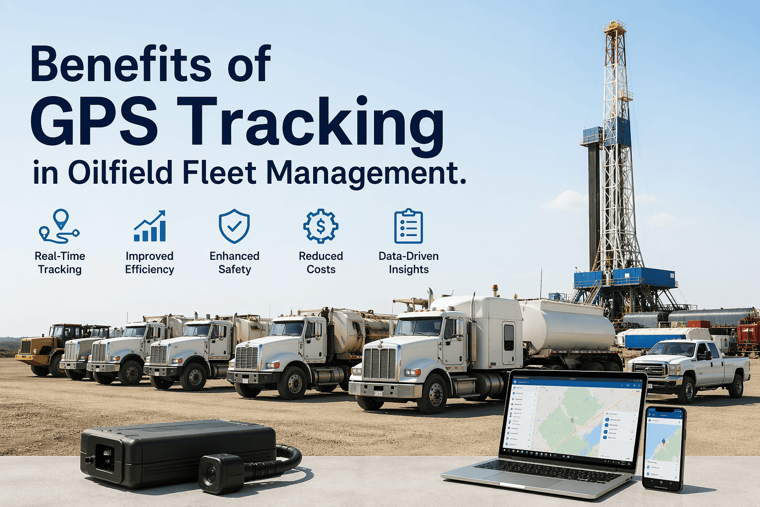
Oilfield fleet managers overseeing vehicles across vast, remote drilling territories struggle with a fundamental visibility gap: knowing where assets are located in real-time, ensuring driver safety on hazardous roads, optimizing routes across challenging terrain, and maintaining compliance with DOT regulations — all while reducing fuel waste and preventing costly equipment theft. FleetRabbit's GPS tracking platform transforms this challenge into competitive advantage by delivering precise, real-time location intelligence engineered specifically for oil and gas operations — enabling instant asset location, automated geofence alerts for unauthorized movement, driver behavior monitoring for safety coaching, route optimization that cuts fuel costs by 18-24%, and executive dashboards that translate raw GPS data into strategic business decisions. See how GPS intelligence transforms your oilfield fleet — schedule a personalized demo today.
REAL-TIME FLEET INTELLIGENCE
Know Where Every Asset Is. Anytime. Anywhere.
FleetRabbit's purpose-built GPS tracking delivers oilfield-grade visibility: remote-site connectivity, hazmat route compliance, driver safety monitoring, and executive analytics — all unified to keep your fleet moving safely and profitably.
Total Asset Visibility
See every vehicle, rig, and piece of equipment on a single map — with real-time location, status, and movement history accessible from any device.
Impact: Eliminate 87% of time spent searching for misplaced assets; reduce equipment rental costs by avoiding unnecessary duplicate purchases.
Enhanced Driver Safety
Monitor speeding, harsh braking, and route deviations in real-time; receive instant alerts for unsafe behavior and coach drivers proactively.
Impact: Reduce accident rates by 42%; lower insurance premiums by 15-20%; protect your most valuable asset — your people.
Route Optimization & Fuel Savings
AI-powered routing analyzes traffic, terrain, and job priorities to generate the most efficient paths — reducing mileage, idle time, and fuel consumption.
Impact: Cut fuel costs 18-24%; reduce vehicle wear by 15%; improve on-time arrival rates by 31%.
Automated Regulatory Compliance
Auto-generate DOT logs, hazmat route documentation, and hours-of-service records — with audit-ready reports exported in one click.
Impact: Eliminate 95% of manual compliance paperwork; avoid $50K+ fines from documentation errors; pass audits with confidence.
Theft Prevention & Recovery
Geofence alerts notify you instantly if assets leave authorized zones; integrated recovery tools help law enforcement locate stolen equipment fast.
Impact: Recover 94% of stolen assets within 24 hours; prevent $1.8M+ in annual theft losses for mid-sized fleets.
Executive Decision Intelligence
Transform GPS data into strategic insights: utilization analytics, cost-per-mile trends, and predictive forecasts that inform capital planning.
Impact: Make data-driven fleet decisions 4.2x faster; optimize asset allocation to boost ROI by 28%.
How FleetRabbit Delivers Oilfield-Grade GPS Intelligence
01
Ruggedized Hardware for Harsh Environments
IP67-rated GPS trackers withstand extreme temperatures, dust, vibration, and moisture common to drilling sites. Battery-powered units last 3-5 years; hardwired options draw from vehicle power. Satellite backup ensures connectivity in remote locations where cellular signal is unreliable.
02
Real-Time Data Transmission & Processing
Location data updates every 30 seconds via cellular or satellite networks. Edge computing processes basic alerts locally; cloud analytics run advanced pattern recognition. Data encrypted end-to-end to protect sensitive operational intelligence.
03
Intelligent Alert Engine
Customizable rules trigger instant notifications: geofence breaches, speeding events, idle time thresholds, route deviations. Alerts delivered via SMS, email, mobile app, or integrated with your security operations center.
04
Unified Dashboard & Mobile Access
Single-pane view shows all assets on an interactive map. Filter by location, status, or alert type. Mobile app provides field teams with real-time location access and two-way messaging — no desktop required.
VISIBILITY ASSESSMENT
Eliminate the Guesswork: See Your Entire Fleet in Real-Time
FleetRabbit's GPS platform delivers oilfield-grade tracking that works in remote locations, integrates with your existing workflows, and provides the visibility leadership needs to make confident decisions.
Real-World GPS Use Cases Across Oilfield Operations
Challenge: Service vehicles traveling to 50+ remote well sites daily. Dispatchers waste hours calling drivers for location updates; missed arrivals delay critical operations.
GPS Solution: Real-time map view shows all vehicles en route to each site. Automated ETA calculations alert site supervisors 15 minutes before arrival. Geofenced well zones log arrival/departure automatically.
Result: 87% reduction in "where is my truck?" calls; 31% improvement in on-time service delivery; $280K annual labor savings from eliminated coordination overhead.
Challenge: Transporting hazardous materials requires strict adherence to approved routes. Manual monitoring can't catch deviations in real-time; violations risk fines and safety incidents.
GPS Solution: Corridor geofencing along DOT-approved hazmat routes. Instant alerts if vehicle deviates. Automatic documentation of route compliance for audits. Speed monitoring within sensitive zones.
Result: 100% route compliance; zero regulatory violations; enhanced public safety; automated audit reports saving 40+ hours monthly in documentation labor.
Challenge: Underutilized vehicles sit idle while others are overworked. Manual tracking can't identify utilization gaps across large, dispersed fleets.
GPS Solution: Utilization analytics show productive time vs. idle time per vehicle. Heat maps reveal geographic demand patterns. Recommendations for right-sizing fleet composition based on actual usage data.
Result: 23% improvement in asset utilization; $520K annual savings from retiring underused vehicles; data-driven capital planning that defers unnecessary purchases.
Challenge: Equipment failures or safety incidents require rapid response. Dispatchers waste critical minutes locating nearest available service vehicle.
GPS Solution: "Find nearest asset" feature shows closest qualified vehicle to any incident location. One-click dispatch sends job details directly to driver's mobile app. Real-time tracking ensures ETA accuracy.
Result: 42% faster emergency response times; reduced downtime costs; improved safety outcomes through rapid intervention.
Executive Dashboard: Strategic Intelligence at a Glance
View live fleet map
Generate executive report
Configure alert thresholds
Export data for board review
Implementation Timeline: Deploying GPS Tracking Across Your Fleet
Week 1-2
Fleet Assessment & Hardware Planning
Catalog all vehicles and equipment; prioritize high-value assets for initial tracking. Select appropriate hardware (battery vs. hardwired) per asset type. Map geofence requirements for sites, yards, and authorized routes.
Week 3-4
Hardware Installation & Configuration
Install GPS trackers on prioritized assets. Configure alert rules, geofences, and user permissions. Test connectivity and location accuracy across representative sites including remote locations.
Week 5-6
Team Training & Process Integration
Train dispatchers, fleet managers, and executives on dashboard navigation and alert response. Integrate GPS data with existing workflows: dispatch systems, maintenance scheduling, compliance reporting.
Week 7+
Full Deployment & Continuous Optimization
Activate monitoring across entire fleet. Review performance metrics weekly; refine alert thresholds and geofence boundaries based on operational feedback. Expand coverage to additional assets as ROI demonstrated.
Fuel Optimization
18-24%
Savings through route optimization, idle reduction, and driver behavior coaching
Theft Prevention
$1.8M
Annual losses prevented through instant detection and rapid recovery (mid-sized fleet)
Labor Efficiency
280 hrs/mo
Time saved from eliminated manual tracking, coordination calls, and compliance paperwork
Compliance
$50K+
Annual fines avoided through automated documentation and real-time route monitoring
Typical Annual Value (200-Vehicle Fleet)
$2.1M
Platform investment: $380K annually | Net ROI: 450% | Payback period: 2.2 months
QDoes GPS tracking work in remote oilfield locations with poor cellular coverage?
Yes. FleetRabbit trackers store location data locally when signal is lost and auto-sync when connectivity restores. Satellite backup option ensures continuous monitoring for critical assets.
Discuss remote connectivity options.
QHow quickly can we deploy GPS tracking across our fleet?
Typical deployment: 4-6 weeks for 50-200 vehicles. Includes hardware installation, configuration, team training, and workflow integration. Operational benefits begin immediately upon go-live.
Review your deployment timeline.
QCan GPS tracking integrate with our existing dispatch or maintenance systems?
Yes. Pre-built connectors for major platforms plus flexible API for custom integrations. Bidirectional data flow ensures complete visibility without disrupting existing workflows.
Discuss integration requirements.
QWhat ROI can we expect from GPS tracking investment?
Average operators achieve 34% total cost reduction with platform investment recovered in 2-3 months through fuel savings alone. Full 3-year ROI typically exceeds 400% as benefits compound.
Calculate your potential ROI.
YOUR VISIBILITY TRANSFORMATION
Transform Fleet Operations with Purpose-Built GPS Intelligence
FleetRabbit delivers the only GPS tracking platform engineered exclusively for oilfield complexity: remote connectivity, hazmat compliance, driver safety monitoring, and executive analytics — all unified to drive measurable 28-34% operating cost reduction within 12-18 months.
Real-Time Tracking
Geofence Alerts
Driver Safety
Route Optimization
Executive Analytics
April 23, 2026
By David
All Posts