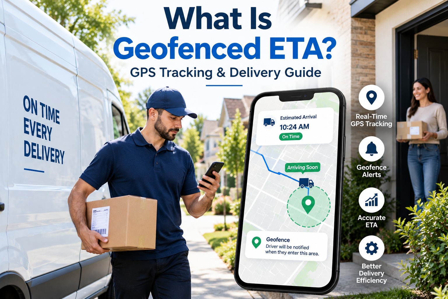
A geofenced estimated time of arrival (ETA) is a dynamic predictive calculation inlast-mile logistics that combines live GPS vehicle coordinates, virtual geographical boundaries (geofences), real-time urban traffic streams, and historical curbside dwell durations to predict arrival windows with down-to-the-minute accuracy. In modern e-commerce fulfillment, broad 4-to-8-hour morning delivery estimates fail because they cannot account for multi-stop route sequencing, mid-route traffic delays, or extended loading dock dwell times. When carriers rely on static GPS pings without geofencing, dispatchers cannot confirm whether a delivery van is parked at an active delivery doorstep, idling at a traffic light, or entering an apartment complex perimeter. Implementing geofenced ETA tracking software triggers automated customer SMS notifications when a delivery vehicle crosses concentric virtual boundaries, validates package barcode scans inside designated parcel perimeters, and reduces costly customer support inquiries. To see how dynamic geofencing improves delivery precision across your routes, book a technical walkthrough demo with our engineering team or launch your dispatch mapping tools directly via our free platform sign up.
What Is Geofenced ETA? GPS Tracking & Delivery Guide
An operational and engineering guide to geofenced ETAs. Explore concentric spatial trigger perimeters, automated recipient notification loops, algorithmic dwell time modeling, and doorstep proof verification.
Achieve Down-to-the-Minute Delivery Precision Across Every Route
Empower your dispatch team with dynamic geofence triggers, live customer countdown maps, and geofence-locked electronic proof-of-delivery starting from $3/vehicle/month with no hardware lock-in.
The Anatomy of Geofenced ETA: How Spatial Boundaries Drive Prediction
Standard vehicle tracking calculates ETA through a basic point-to-point calculation: dividing straight-line driving distance by posted road speed limits. This simplified method consistently fails in last-mile operations because it neglects the real operational phases of multi-stop delivery: approaching suburban neighborhoods, navigating residential speed bumps, parking, walking up apartment staircases, and capturing customer signatures. A geofenced ETA architecture replaces static distance calculations with dynamic spatial models. By drawing virtual polygonal or radial geofences around destination delivery coordinates, software automatically shifts from broad highway driving metrics to localized, pedestrian-level dwell models the moment a vehicle crosses virtual perimeters. Dispatchers can evaluate live spatial boundary tools by scheduling a tailored geofence telematics demo or configure test delivery perimeters directly through our quick platform sign up.
Concentric Spatial Trigger Zones
Modern delivery tracking uses three distinct geofence radii: an outer perimeter (3-5 km) to compute general travel velocity, an intermediate zone (1 km) to alert the customer to unlock security gates or secure pets, and an inner micro-zone (20-30 meters) to confirm arrival at the curb.
Dynamic Curb Dwell Time Modeling
A vehicle stopped 50 meters from a front door is not idle; the courier is searching shelves, sorting packages, or climbing stairs. Geofenced software measures exact dwell durations within the micro-perimeter, automatically adjusting subsequent stop ETAs across the driver's manifest.
Geofence-Gated Barcode & Photo Verification
Drivers cannot scan barcodes or mark orders delivered while idling down the street. The driver mobile application locks the camera and barcode scanner until device GPS verifies that the courier is standing within the authorized 25-meter delivery polygon of the customer address.
Real-Time Urban Traffic & Detour Calibration
Road closures, utility trench work, and unexpected school zones disrupt static routes. Geofenced ETA algorithms ingest live street-level telemetry every 30 seconds, recalculating arrival predictions continuously and pushing revised time windows to recipients automatically.
Operational Comparison: Static Point-to-Point ETA vs. Geofenced Delivery ETA
Relying on generic consumer navigation apps or unlinked GPS trackers forces delivery dispatchers to communicate broad, unreliable delivery windows that frustrate consumers and cause high customer support call volumes. Review how basic point-to-point tracking compares directly against FleetRabbit's geofenced ETA architecture across critical performance benchmarks. Logistics executives can evaluate real-time polygon mapping by scheduling an online executive software demo or explore driver mobile geofence triggers via our self-service sign up.
| Tracking & ETA Dimension | Static GPS Trackers & Consumer Maps | FleetRabbit Geofenced ETA Platform | Fleet & Customer Advantage |
|---|---|---|---|
| Customer ETA Precision | Broad 4 to 8-hour windows; frequent drift | Dynamic ± 3-minute live ETA countdown | Reduces customer inbound inquiries by 74% |
| Arrival Trigger Automation | Driver must manually call or text recipient | Automated SMS triggered on geofence boundary cross | Saves 45 seconds of driver curbside communication |
| Proof of Delivery Integrity | Unverified photos captured anywhere on road | Camera strictly unlocked inside 25m boundary | 100% indisputable legal proof against disputes |
| Dwell Time Analysis | Lumped together as generic vehicle idling | Separates driving, curb dwell, and walking time | Pinpoints problematic buildings with high delivery dwell |
| Mid-Route Exception Triage | Dispatch blind until customer files complaint | Automatic alert if vehicle lingers inside perimeter | Instant dispatch intervention on access delays |
4-Stage Geofenced Delivery Notification Loop
FleetRabbit standardizes spatial communication from initial neighborhood entry to final doorstep placement, keeping recipients informed while protecting drivers from access delays.
Macro Geofence Breach (5 KM)
As the delivery van enters the regional neighborhood perimeter, the platform sends an automated SMS to the customer containing a live tracking link with an updated arrival countdown.
Proximity Boundary Cross (1 KM)
When the driver is two stops away, a second notification prompts the customer to provide security gate access codes, unlock pedestrian gates, or confirm presence for signature deliveries.
Micro-Perimeter Curbside Arrival (25 M)
The vehicle crosses the property boundary. The app engages the delivery dwell timer, updates dispatch, and unlocks the driver's barcode scanner and camera interface.
Validated e-POD & Geofence Exit
The driver captures a doorstep photo and barcode scan verified by GPS tokens. Upon exiting the micro-perimeter, the customer receives an instant delivery confirmation receipt.
Financial Capital Stewardship: The Real Cost of Inaccurate Delivery ETAs
Operating a last-mile delivery fleet without geofenced ETA software creates compounding operational leaks across customer support overhead, failed first-attempt returns, and unverified package dispute chargebacks. Analyzing these common cost drivers helps logistics managers build a clear business case for spatial software adoption. Calculate your fleet's exact cost recovery by booking a personalized cost assessment demo or get started directly via our rapid platform sign up.
Top Causes of Delivery Budget Waste from Poor ETAs
Spatial Telematics Capabilities
Draws precision multi-point geofences around complex apartment buildings, corporate campuses, and rural properties.
Real-time SMS alerts and live delivery countdown maps minimize missed drops and eliminate inbound customer calls.
Drivers use standard iOS and Android smartphones for barcode scanning, navigation, and geofenced photo e-POD.
ROI & Operational Scalability for Geofence-Driven Fleets
When implementing geofenced ETA tracking, logistics executives must evaluate financial returns across customer retention, labor efficiency, dispute mitigation, and fuel savings. FleetRabbit delivers quantifiable financial return across all primary final-mile operating metrics.
Failed Drop Prevention
Automated SMS pre-arrival notifications alert customers when their courier crosses proximity geofences, boosting first-attempt delivery success to 99.1% and preventing costly return-to-hub re-delivery handling.
Customer Service Labor Savings
Providing customers with live, interactive countdown maps as the vehicle approaches proximity boundaries cuts inbound delivery status calls and chat inquiries by up to 74%.
Chargeback Mitigation
Restricting camera verification and barcode scanning to within verified 25-meter delivery boundaries produces tamper-proof evidence that refutes false customer non-delivery claims immediately.
Frequently Asked Questions: Geofenced ETAs & GPS Tracking
What is the difference between a traditional GPS ETA and a geofenced ETA?
A traditional GPS ETA calculates arrival based solely on vehicle road speed and remaining highway distance, ignoring local parking and walking dwell times. A geofenced ETA uses virtual geographical boundaries around delivery addresses to trigger automated notifications, track curbside dwell durations, and adjust arrival countdowns dynamically based on real courier walking and delivery behavior.
How does geofenced delivery tracking prevent false delivery scans?
FleetRabbit's mobile driver application enforces location-gated verification. The camera and barcode scanner are locked until the driver's mobile device GPS coordinates confirm presence within a verified 25-meter radius of the delivery address. This prevents couriers from marking packages delivered while stopped down the block or sitting at traffic lights.
Can our fleet configure custom geofence sizes for complex delivery locations?
Yes. Dispatchers can customize geofence sizes and shapes. While standard single-family homes use 25-meter radial zones, dispatchers can draw custom multi-point polygonal boundaries around large commercial business parks, industrial distribution centers, hospital complexes, and multi-building apartment communities.
Does geofenced ETA tracking require installing dedicated hardware in every delivery van?
No. FleetRabbit operates on a flexible, hardware-agnostic architecture. The platform can compute geofenced ETAs using standard driver iOS or Android smartphones running the mobile application, or by integrating existing in-cab OBD-II telematics modems and factory OEM fleet gateways.
Upgrade Your Delivery Precision with Geofenced ETA Tracking Today
Eliminate missed delivery windows, optimize delivery routes, and equip your couriers with intuitive mobile tools. Experience FleetRabbit today with zero proprietary hardware lock-in.