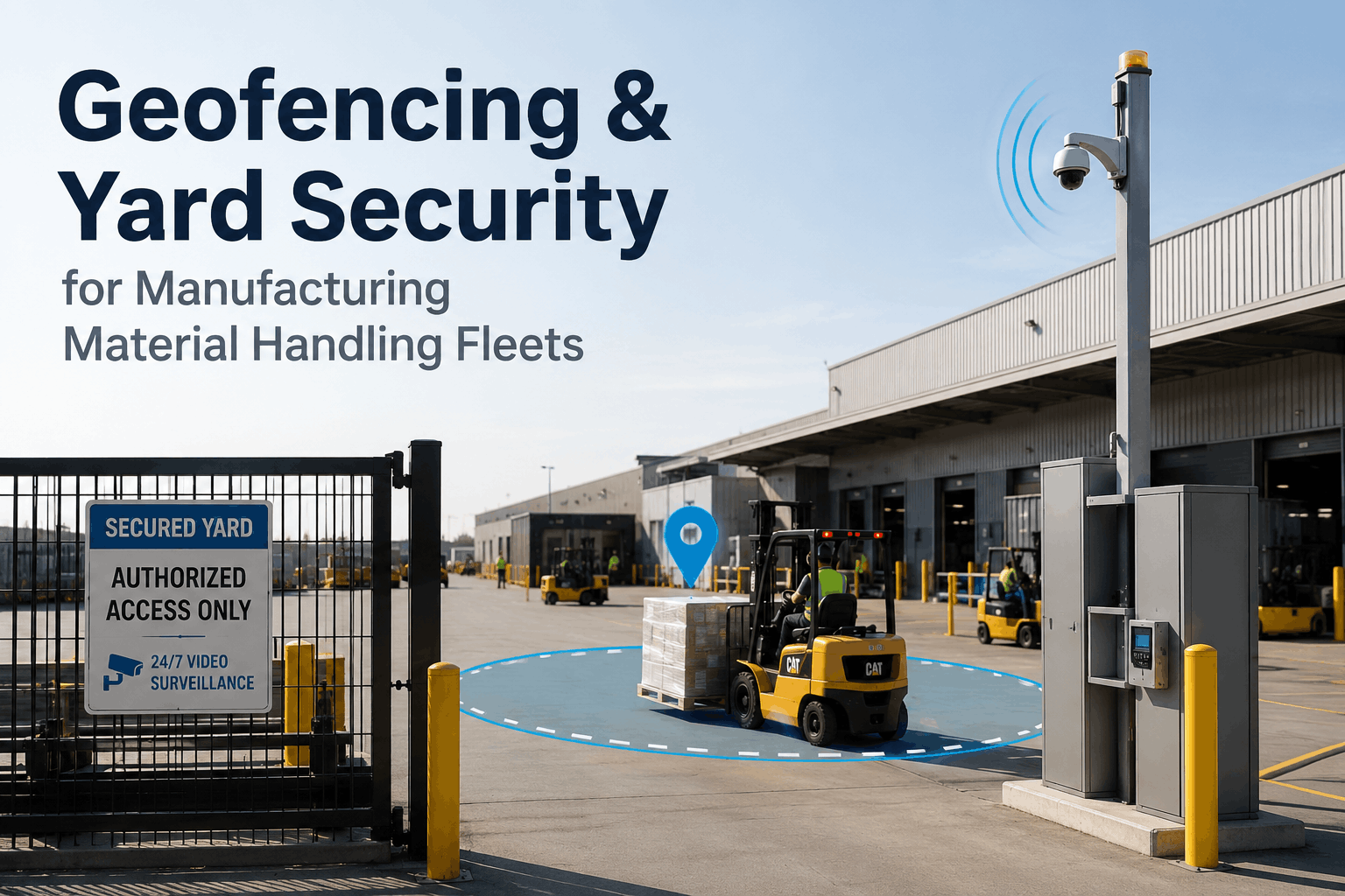
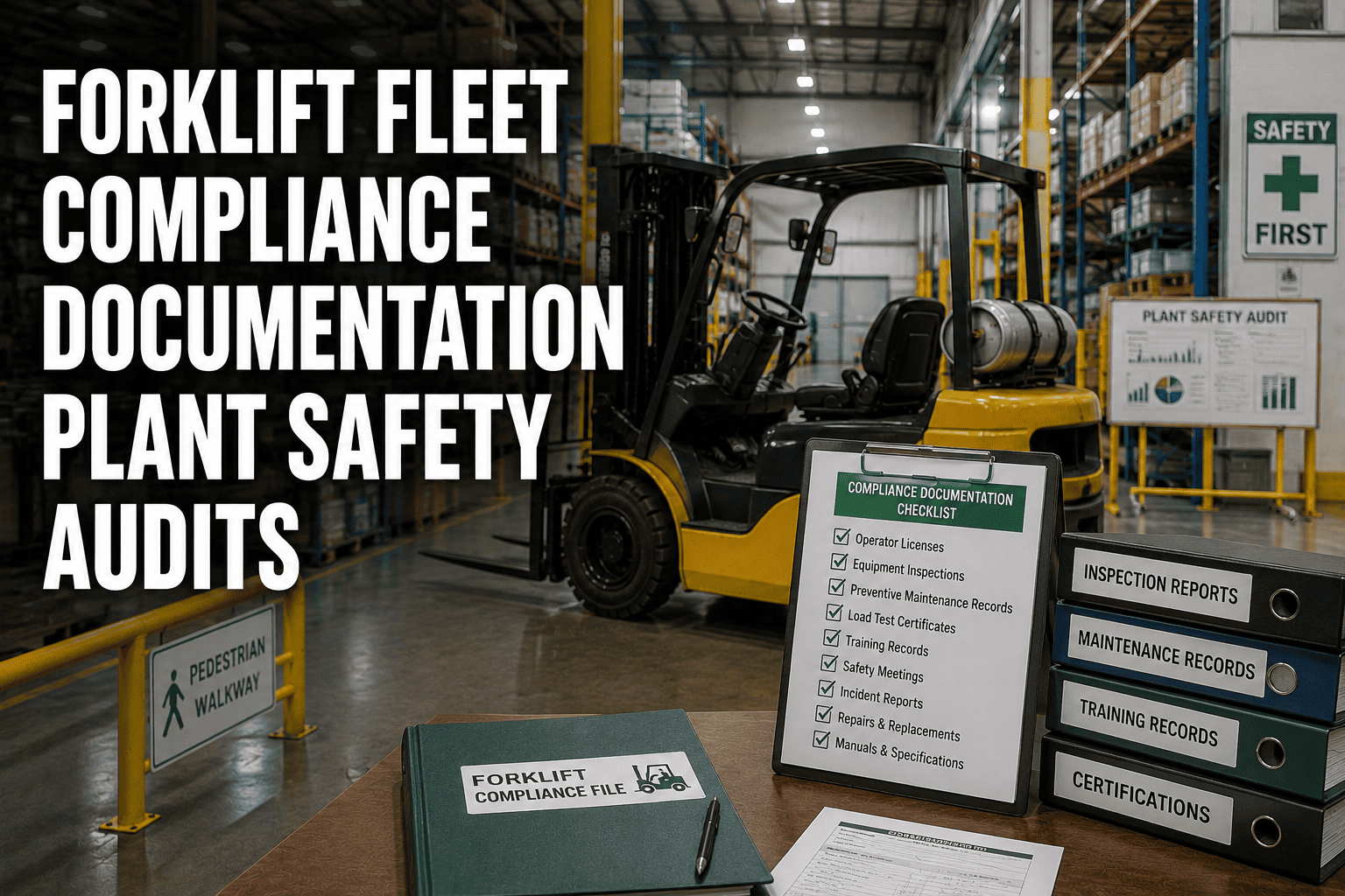
Geofencing & Yard Security for Manufacturing Material Handling Fleets
When a counterbalance forklift operating on the night shift crosses into a pedestrian-priority corridor at 11.4 km/h — because the zone boundary exists only as a painted floor line that the driver can't see in low light, and the fleet management system has no record of where that machine has been for the past three hours — the safety exposure isn't a future risk. It's a present condition that your industrial safety officer won't find until an incident report triggers a retrospective investigation. Manufacturing plant geofencing is not a surveillance technology. It is the operational infrastructure that converts physical risk zones into active, documented, enforceable boundaries — giving every forklift, every reach truck, and every tow tractor a real-time relationship with the space it operates in that no painted line, no policy notice, and no manual supervisor check can replicate.
This guide gives manufacturing plant safety managers, material handling fleet supervisors, and industrial logistics directors a comprehensive framework for implementing geofencing and yard security across manufacturing plant floors, external yards, and warehouse material handling environments. We cover virtual boundary configuration for forklifts, GPS geofencing for material handling fleets, automated speed control by zone, unauthorised access prevention, equipment tracking in manufacturing, and the connected platform capabilities that close the security and safety gaps that manual operations leave permanently open. Manufacturing operations ready to build genuine yard security intelligence can start their free trial today.
Geofencing & Yard Security for Manufacturing Material Handling Fleets
How GPS geofencing, virtual boundary enforcement, automated forklift speed control, and real-time equipment tracking close the yard security gaps that painted lines, radio communication, and manual guard checks leave permanently open in manufacturing material handling operations.
of industrial forklift incidents involve unrestricted zone access or unmonitored speed in unsupervised areas
88%
reduction in unauthorised zone entry events for plants using automated geofencing yard security
75%
of industrial equipment theft incidents occur in unmonitored external yards during off-shift hours
<30sAlert delivery from geofence breach to security team
24/7Automated unauthorised access detection — no manual monitoring required
AutoSpeed limit enforcement on zone entry — no operator action needed
100%Zone access events with timestamped digital security record
Why Painted Lines Aren't a Yard Security System
The manufacturing industry has relied on painted floor markings, safety signage, and supervisory observation as its primary zone enforcement mechanism for decades. These controls have three structural failures that geofencing addresses directly: they are visible only when a driver is looking at them, they generate no record of whether they were observed or violated, and they enforce nothing when no supervisor is present. In a manufacturing plant operating across two or three shifts with material handling equipment moving continuously through shared pedestrian and vehicle spaces, these are not minor shortcomings — they are systematic gaps that accumulate as unreported near-misses and uninvestigated low-speed incidents until a more serious event forces a retrospective review of a safety record that was never built.
The Three Structural Failures of Manual Yard Security — and What Geofencing Replaces Each One With
Manual Control
Painted Floor Markings
Visible only when observed. No alert on violation. No record generated. Invisible in low light, obscured by debris, ignored under time pressure.
→
Geofencing Replacement
Virtual Zone Boundaries
GPS-enforced digital boundary active 24/7. Breach detected in real time. Alert fired to security. Violation logged automatically regardless of lighting or supervision.
Manual Control
Speed Limit Signage
Relies entirely on driver compliance. No enforcement mechanism. No speed data captured. Violations invisible until an incident makes them impossible to ignore.
→
Geofencing Replacement
Automated Speed Enforcement
Speed automatically reduced on zone entry via telematics — no driver action required. Every speed event logged per operator per shift with timestamp and zone for safety trending.
Manual Control
Guard Patrols & Radio Checks
Coverage exists only when a guard is present. Gaps between patrol cycles are unmonitored. No searchable access history. Night shift and weekend coverage is consistently the weakest.
→
Geofencing Replacement
Continuous Zone Monitoring
Every zone monitored continuously without patrol cycles or coverage gaps. After-hours breach alerts routed immediately to security contacts. Full searchable access history for every zone by date, time, and vehicle.
Virtual Boundary Architecture: Mapping Your Plant for Geofence Security
Effective geofencing for manufacturing material handling fleets begins with zone architecture — the process of mapping every operationally and safety-significant area of your facility into a set of named, digitally enforced virtual boundaries, each with its own access rules, speed limits, alert thresholds, and documentation requirements. A facility that deploys geofencing without a structured zone architecture gets perimeter tracking. A facility that builds a complete zone map gets an active safety and security intelligence system that knows where every machine is, what it should be doing there, and whether what it is actually doing matches.
Manufacturing Plant Geofence Zone ArchitectureSeven standard zone types and their geofence security configuration
Z1
Gate & Perimeter Entry
External / Visitor
Medium
Arrival timestampPermit validationVisitor log
All inbound vehicles GPS-timestamped on entry. Unregistered vehicles trigger immediate alert. Contractor permit status checked automatically against departure authorisation record.
Z2
External Yard & Staging
Vehicle / Equipment
Medium
Dwell timerEquipment checkAfter-hours alert
Equipment dwell monitoring detects forklifts or vehicles parked in the external yard beyond authorised windows. After-hours presence triggers immediate security alert with GPS location pinpoint.
Z3
Loading Dock Interface
Shared / Controlled
High
Speed: 5 km/h maxSchedule checkDuration log
Automatic speed reduction on entry to dock interface zone. Vehicle identity confirmed against dock schedule — unscheduled access blocked and alerted. Every access event logged with duration for compliance documentation.
Z4
Active Production Floor
Restricted / Managed
High
Speed: 8 km/h maxOperator IDShift window
Only authorised, shift-certified operators permitted during active production windows. Speed continuously enforced via telematics. Any unregistered equipment entering the production zone during off-shift triggers immediate safety alert.
Z5
Pedestrian Crossing Corridors
Safety / Priority
Critical
Speed: 3 km/h maxProximity alertImmediate log
Strictest speed enforcement zone in the facility. Automatic deceleration to 3 km/h on zone entry. Pedestrian proximity sensor integration available. Every entry logged individually for operator safety assessment and incident prevention trending.
Z6
High-Value Equipment Compound
Secure / Asset
Critical
Hard exclusionTheft alertGPS pin
Permanent virtual perimeter around highest-value plant assets. Any equipment exit outside authorised hours fires simultaneous alerts to security, plant manager, and designated contacts with live GPS coordinates for immediate recovery response.
Z7
Hazardous Material Storage
Restricted / Compliance
Critical
Hard exclusionCompliance logInstant alert
Zero-tolerance exclusion zone for unauthorised equipment. Every access event — authorised or not — generates a full compliance record for safety audit and regulatory documentation. Breach alerts fire with full vehicle, operator, and timestamp data.
Medium Risk ZoneHigh Risk Zone — Speed enforcement activeCritical Zone — Hard exclusion or maximum enforcement
Forklift Speed Control Geofencing: How Automated Enforcement Works
Forklift speed control is the single most impactful safety application of manufacturing geofencing — and the one most commonly misunderstood as a driver compliance tool rather than a system capability. Speed limit signage in a manufacturing plant enforces nothing. A driver under time pressure, operating on a familiar route, or simply unaware of a zone boundary change will not reliably reduce speed to comply with a sign. Automated geofence speed control removes the driver compliance variable entirely: when a tracked forklift enters a defined speed zone, the maximum travel speed is physically reduced to the zone limit by the telematics control unit — without requiring any driver awareness, input, or compliance decision.
How Automated Forklift Speed Control Works
Zone Entry Detected
GPS telematics unit detects the forklift crossing into a configured speed zone boundary — updated at intervals of 1–3 seconds depending on zone sensitivity configuration.
Speed Cap Signal Transmitted
Platform transmits zone-specific speed cap to the vehicle control unit. Maximum travel speed is limited to the configured zone threshold — 3, 5, or 8 km/h depending on zone classification.
Operator Notification (Optional)
Cab unit displays zone entry notification and active speed limit to the operator. Driver is informed but speed restriction is already active — notification is informational, not a compliance request.
Event Logged to Safety Record
Zone entry, applied speed limit, time in zone, and exit timestamp are written to the operator's safety record — building a continuous compliance history without manual supervisor observation.
Zone Exit — Restriction Lifted
Speed restriction automatically removed when the forklift exits the zone boundary. Normal operating speed resumes without any driver or dispatcher action required.
Speed Control Impact Data
61%
Reduction in speed-related near-miss events within 90 days of automated enforcement activation
0
Manual supervisor observations required for continuous zone speed enforcement across the fleet
100%
Speed zone entry events captured with operator ID, zone, timestamp, and duration in safety record
3x
More speed compliance data generated per shift than manual observation programmes produce per month
Manual Yard Security vs. Geofencing Automation: The Safety and Compliance Gap
The operational gap between a manual yard security operation and a geofencing-enabled industrial fleet management system is not a difference in response speed or documentation quality. It is a difference in what the organisation can see at all. Facilities managing material handling security on painted markings, guard checks, and radio communication are generating safety and compliance exposure continuously — exposure that is invisible until an incident, an insurance audit, or an HSE inspection makes it impossible to ignore.
Material Handling Yard Security: Manual Operations vs. Geofencing Automation
✗Manual Yard Security Operations
Zone violations detected only when supervisor is physically present in the area
Forklift speed compliance entirely dependent on individual driver behaviour and signage awareness
Safety audit requires manual CCTV review and guard log reconstruction — typically 2–3 days minimum
Night shift and weekend periods have longest unmonitored windows and highest incident frequency
Blind, Exposed & Undefendable in Audit
✓FleetRabbit Geofencing Yard Security
Zone breaches detected and alerted within 30 seconds regardless of supervisor location or shift
Speed enforcement automated on zone entry — active on every machine, every shift, with zero observation overhead
Real-time GPS equipment location visible on dashboard — after-hours movement alerts fire in seconds
Contractor and visitor vehicle routing confirmed by geofence position with automatic digital access log
Every zone access, speed event, and approach logged automatically — near-miss data captured without self-reporting
One-click security report covers every vehicle and zone event across any date range in under 60 seconds
Continuous monitoring is shift-agnostic — night and weekend coverage identical to supervised day shift
Visible, Controlled & Audit-Ready at Any Time
Equipment Tracking in Manufacturing: From Location Awareness to Security Intelligence
GPS equipment tracking in manufacturing plants is frequently deployed as a utilisation tool — knowing which forklifts are active and where they are parked at end of shift. This is useful. But the security and safety value of equipment tracking compounds significantly when it is connected to geofence zone logic, operating schedule data, and after-hours alert workflows — converting location awareness into active security intelligence that protects against theft, detects misuse, and provides the documented equipment history that insurance assessments and regulatory investigations require.
Utilisation Tracking
Real-Time Fleet Position Dashboard
Every forklift, reach truck, and tow tractor visible on the plant floor map in real time — with zone assignment, operator ID, speed, and operational status displayed continuously to fleet supervisors without manual check-in.
Security Intelligence
After-Hours Movement Detection
Any equipment movement detected outside configured operating hours triggers an immediate multi-channel alert to security, plant management, and designated contacts — with live GPS coordinates for rapid intervention and recovery response.
Compliance Record
Operator & Equipment Audit Trail
Every machine's complete movement history — zones visited, time in each zone, speed events, operator ID per session, and any geofence breach events — stored in a searchable archive for HSE audit, insurance assessment, and incident investigation.
Maintenance Trigger
Operating Hours & Service Scheduling
Equipment operating hours accumulated automatically from GPS activity data — triggering maintenance scheduling notifications at configured service intervals and providing a certified hours record that supports warranty claims and pre-sale asset valuation.
Risk Prevention
Operator Behaviour Pattern Analysis
Speed event frequency, restricted zone access patterns, and operating schedule deviations analysed per operator across rolling periods — identifying high-risk behaviour patterns for targeted safety intervention before a pattern becomes an incident.
Multi-Site
Multi-Site Network Fleet View
Operations directors with multi-site manufacturing networks see a consolidated view of all equipment positions, zone alert statuses, and security events across all facilities from a single dashboard — with site-level drill-down for individual facility management.
Every Forklift Tracked. Every Zone Enforced. Every Shift Documented.
FleetRabbit gives manufacturing plants and material handling fleets GPS geofencing across every operational zone, automated forklift speed control, virtual boundary enforcement, equipment theft detection, contractor access management, operator behaviour analytics, and automatic safety compliance documentation — on every shift, for every machine, without manual monitoring overhead.
Manufacturing Plant GeofencingForklift Yard SecurityVirtual Boundaries ForkliftsForklift Speed Control GeofencingEquipment Tracking ManufacturingIndustrial Fleet SafetyPlant Yard SecurityGPS Geofencing Material Handling
How does GPS geofencing work inside a building where GPS signal is weak or absent?
Indoor positioning for manufacturing geofencing uses a combination of technologies depending on facility size and structure. In facilities with adequate GPS signal penetration — typical in large single-floor manufacturing plants and warehouses with metal-framed rather than reinforced concrete roofing — standard GPS delivers sufficient positioning accuracy for zone enforcement. For environments where GPS signal is degraded, FleetRabbit supports supplementary positioning through Wi-Fi triangulation, Bluetooth beacon networks installed at zone boundaries, and UWB (ultra-wideband) anchors for sub-metre precision in critical zones. The positioning technology is selected and configured during the facility deployment survey, and in most manufacturing environments a hybrid approach of GPS plus periodic beacon confirmation delivers the zone enforcement accuracy required without full indoor positioning infrastructure. For external yards, GPS delivers full accuracy without supplementation.
What telematics hardware is required on existing forklifts for speed control geofencing?
Automated speed control geofencing requires a vehicle-mounted telematics control unit (TCU) that integrates with the forklift's drive control system. For most modern electric and counterbalance forklifts from major manufacturers — Toyota, Linde, Crown, Hyster, Yale, Jungheinrich — integration is achieved through a CAN bus connection that allows the TCU to issue speed cap commands directly to the drive controller. For older equipment without CAN bus access, an inline controller is installed between the throttle and drive system that intercepts and limits the speed signal. The deployment team conducts a vehicle compatibility survey before hardware selection to identify the correct interface method for each unit in the fleet. Installation is typically completed in 45–90 minutes per vehicle without requiring specialist OEM technicians, and the hardware is removable and transferable if equipment is sold or replaced. Vehicles that cannot support active speed control due to drive system architecture can still be tracked and alerted on for zone monitoring and security functions.
How are geofence zone boundaries configured and updated when plant layouts change?
Zone boundaries are configured in the FleetRabbit platform using a digital facility map layer, either imported from existing CAD or AutoCAD drawings or built from scratch using the platform's zone mapping tool. Zone boundaries are drawn as polygons on the map, then assigned their configuration properties — speed limits, access rules, alert recipients, operating windows, and documentation requirements. Boundary updates are made entirely through the platform interface without hardware changes or on-site visits: a plant manager or safety officer with appropriate access can redraw a zone boundary, update a speed limit, add an alert contact, or change an operating window in under five minutes, with the change taking effect on all connected vehicles within the next positioning refresh cycle. This means that seasonal layout changes, new production line installations, or revised pedestrian routing can be reflected in the active geofence configuration on the same day the physical change is made, rather than waiting for a maintenance visit or line marking team.
What safety and compliance documentation does the platform generate automatically for HSE audits?
The platform generates three categories of safety and compliance documentation automatically. First, per-machine records: every forklift's complete operating history including zones accessed, time in each zone, speed events logged, operator sessions, and any geofence breach events — stored per calendar period and exportable by date range for any vehicle in the fleet. Second, per-operator records: individual operator behaviour profiles showing zone access frequency, speed compliance rate by zone, restricted zone approach events, and operating hour totals — providing the evidence base for targeted safety training decisions and operator performance reviews. Third, per-incident packages: when a safety event, near-miss, or breach alert is triggered, the platform generates a pre-built data package for that event containing vehicle position history, operator identity, speed data, and zone access record for the period surrounding the event — replacing the manual CCTV review and log reconstruction that currently follows every incident investigation. All records are stored with a minimum two-year retention period and are exportable as structured PDFs for HSE submission, insurance claim, or legal proceeding documentation.
How quickly can geofencing and yard security be deployed across an existing manufacturing facility?
For a single-facility deployment covering gate entry, internal zone monitoring, forklift tracking, speed control activation, and equipment compound security, the platform is typically operational within 14 to 21 days from project initiation. The process begins with a facility mapping session — configuring geofence boundaries across all designated zones from your plant layout drawings — followed by vehicle hardware installation, asset registration, alert routing configuration, and safety dashboard setup. Speed control calibration and operator notification configuration are completed in the second week alongside security alert routing to your designated contacts. For facilities with existing telematics hardware on some vehicles, compatible units are integrated during the same deployment window rather than replaced. Multi-facility network deployments are phased by site with a 10–14 day lead per facility. The FleetRabbit implementation team conducts a live yard security test at each facility before marking it operational — confirming zone boundaries, alert delivery, speed control activation, and documentation capture across a simulated full operating cycle before the first live shift begins.