A loader goes missing from the shift roster at your northern pit. Someone thinks it was moved to the secondary site for a job last week, but nobody can confirm it, and the spreadsheet that's supposed to track cross-site transfers hasn't been updated since Tuesday. Multiply that scenario across three or four operations running independently, and you get the real problem behind multi-site mining: not a lack of data, but data trapped in separate systems that never talk to each other.
Running equipment across multiple pits, quarries, or regions means every site manager sees their own slice of the fleet, while nobody above them sees the whole picture at once. Multi-site mining equipment tracking software exists to close that gap, putting every asset, at every location, on one live map instead of ten disconnected ones.
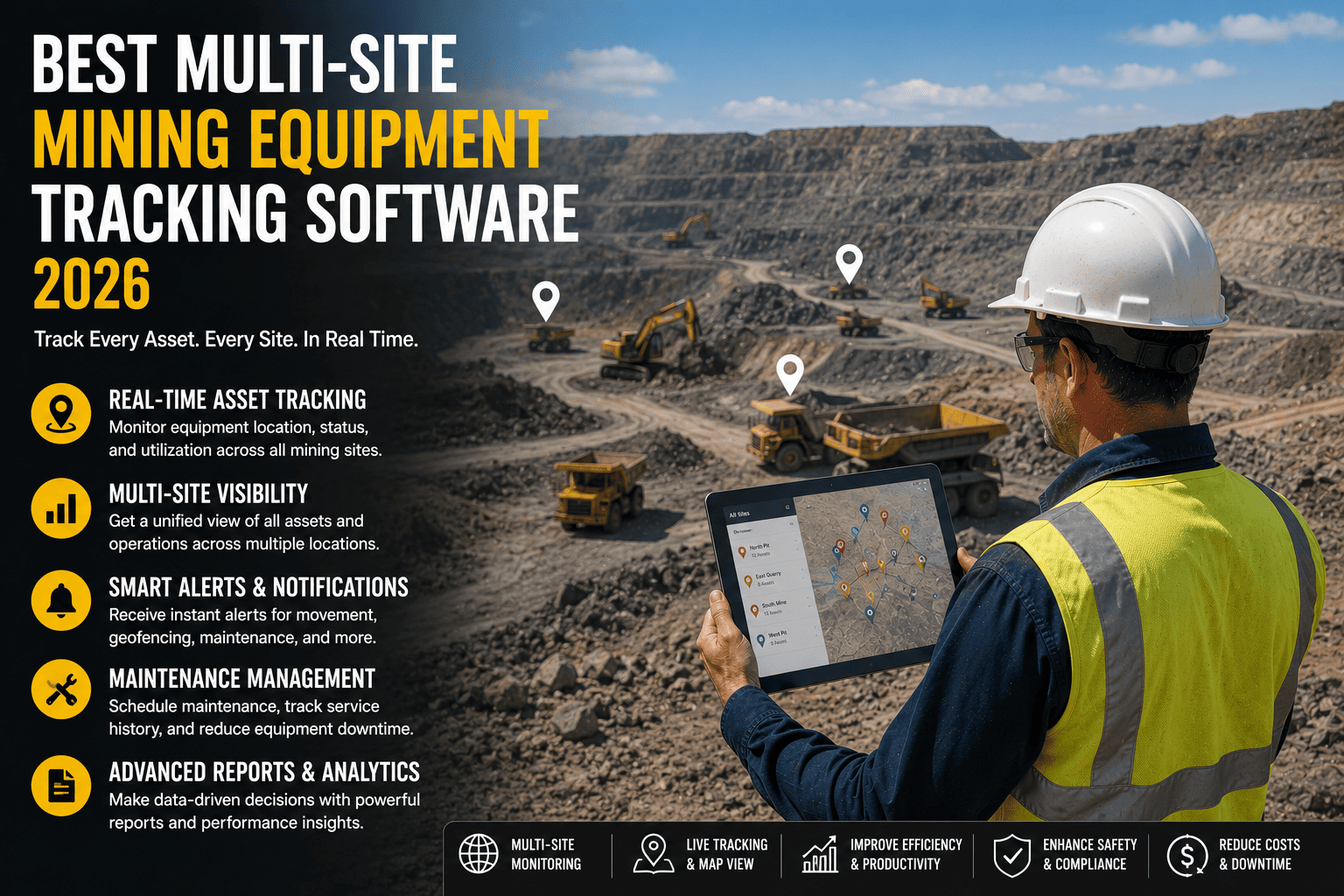
The best multi-site mining equipment tracking software gives operators a single dashboard showing real-time GPS location, utilization, and idle time for every asset across every pit, quarry, or region, with offline-first data capture for zero-signal zones. Mines using unified tracking commonly lift equipment utilization by 15 to 20 percent within a quarter and cut time spent locating assets significantly. Sign up free to see your fleet unified on one map.
Why Managing Sites Separately Costs You Equipment
Every mine that grows past a single pit eventually hits the same wall. Local systems work fine in isolation, but the moment leadership needs to compare performance or move equipment between locations, the cracks show. Here's where that visibility gap actually costs money.
FleetRabbit puts every haul truck, loader, excavator, and drill rig from every location on a single live dashboard, with utilization and idle-time data updating automatically as shifts run. Compare sites side by side instead of stitching together spreadsheets.
What a Real Multi-Site Tracking Platform Shows You
Not every GPS tool built for trucking translates to mining across several remote locations. The right platform needs to hold up underground, across dead zones, and across every site you manage from one login.
Live Location Across Every Site
Every haul truck, loader, excavator, and drill rig should appear on one map, regardless of which pit or quarry it's sitting in right now, with position updating in real time as shifts run.
Utilization and Idle Time, Compared Side By Side
Raw location data tells you where something is. Utilization data tells you whether it should be somewhere else. Comparing scheduled hours against actual working hours across sites reveals which locations are overstaffed with equipment and which are running short.
Offline-First Data Capture
Underground drives and remote pits lose signal constantly. A platform built for mining keeps recording position, speed, and engine status locally, then syncs automatically the moment connectivity returns, so no site ever goes dark in the dashboard.
Why This Matters Across Multiple Locations
A single-site tool can get away with assuming steady connectivity. A multi-site platform can't, because the odds that at least one location is in a dead zone at any given moment only go up as you add sites.
Comparing Sites: What the Dashboard Should Answer
The real value of multi-site software shows up the moment you ask a question that spans more than one location. Below is what a manager should be able to answer in seconds instead of a week of manual report review.
| Question a Manager Asks | Without Unified Tracking | With FleetRabbit |
|---|---|---|
| Which site has an idle loader we could redeploy | Phone calls to each site supervisor | Visible instantly on the live utilization view |
| Where is the excavator we moved last month | Depends on someone remembering to log it | Live location and full movement history |
| Which site is running below target utilization | Discovered weeks later during report review | Flagged automatically on the shared dashboard |
| Are geofence and safety alerts consistent | Different rules and tools at each location | One standardized alert system across all sites |
| How does Site A compare to Site B this month | Manual export and spreadsheet merge | Side-by-side reporting, ready on demand |
Rolling Out Tracking Across Multiple Locations
Connecting several sites to one platform sounds like a heavier lift than it actually is. Most mining operations get every asset visible within a day once the groundwork is in place.
Step One: Connect Existing Telematics
If telematics hardware is already installed on equipment at any site, connecting the provider starts the flow of location data immediately, without needing to touch the machines themselves.
Step Two: Standardize Zones and Alerts
Mark blast zones, restricted areas, and haul roads consistently across every location, and assign who receives alerts, so every site operates under the same safety rules instead of separate local ones.
Step Three: Set Utilization Baselines Per Site
Define expected working hours for each asset type at each location, so the dashboard can flag idle time and underused equipment automatically instead of managers calculating it site by site.
What to Expect in the First Week
Within a day of connecting your sites, every tracked asset appears on the live map and utilization data starts populating. Within the first week, most teams spot at least one clear pattern, an idle machine at one site that could cover a shortage at another. If you'd rather walk through your specific site list with someone first, you can book a demo and map it out together.
FleetRabbit connects every location you operate into a single live dashboard, with real-time position, utilization, and geofence alerts standardized across all your sites. Get every asset visible within a day.
Frequently Asked Questions
Scattered spreadsheets and site-by-site radio checks cost you utilization every single shift. FleetRabbit unifies location, idle-time, and utilization data across every pit, quarry, and region you operate, so decisions happen in seconds instead of weeks.