.png)
Real-time GPS fleet tracking has evolved from a nice-to-have feature to an operational necessity for transportation companies managing commercial vehicle fleets. For dispatchers, fleet managers, and safety directors, the difference between knowing where a vehicle is and knowing where it's supposed to be can mean the difference between on-time delivery and missed windows, between proactive maintenance and roadside breakdowns, between driver safety and liability exposure. This comprehensive guide explains why real-time GPS tracking matters for transportation companies, what capabilities distinguish enterprise-grade solutions from basic tracking apps, and how FleetRabbit's GPS tracking module integrates with maintenance, compliance, and operational intelligence to deliver visibility that actually drives decisions rather than just displaying map pins.
2026 GPS Tracking Reality for Transportation Fleets
Transportation companies operating without real-time vehicle visibility face compounding operational risks. Delayed delivery notifications mean customers receive false ETAs. Unauthorized route deviations go undetected until customers complain or loads arrive late. Vehicle breakdowns happen in the field with no advance warning, stranding drivers and loads. Fuel theft and idle-time waste continue because managers lack consumption data. Driver behavior that creates safety and liability risk remains invisible until accidents occur. Fleets implementing real-time GPS tracking with integrated maintenance and compliance data report 25-35% reduction in fuel costs, 20-30% improvement in on-time delivery, and measurable liability reduction through documented driver behavior monitoring and safety interventions.
Keep Your Fleet Visible, Connected, and Compliant
FleetRabbit's real-time GPS tracking connects live vehicle location with maintenance schedules, driver behavior data, and DOT compliance records so every decision is made with complete operational visibility.
What Real-Time GPS Fleet Tracking Actually Does
Real-time GPS fleet tracking is not simply a map showing where vehicles are. Enterprise-grade GPS tracking connects continuous location data with vehicle performance, driver behavior, operational context, and business systems so that location information automatically triggers decisions rather than requiring manual interpretation. When a truck leaves its planned route, dispatch knows immediately whether the deviation is a traffic reroute or an unauthorized stop. When a vehicle's speed and acceleration patterns suggest aggressive driving, safety managers can intervene with coaching before liability exposure increases. When GPS data shows a vehicle is approaching its next scheduled maintenance interval, the system can pre-position service appointments and parts availability. When a driver has been idling in excess of normal rest patterns, fuel waste alerts go to operations. Real-time GPS is valuable precisely because it integrates with maintenance schedules, compliance tracking, fuel management, and driver safety programs to create actionable intelligence.
Live Vehicle Location and Movement Tracking
Every active vehicle transmits its location continuously to a central dashboard. Fleet managers and dispatchers see real-time positions, movement direction, current speed, and historical movement patterns for each vehicle. Location data updates continuously throughout the day, allowing dispatchers to monitor vehicle progress against scheduled routes and estimated arrival times. Multi-vehicle fleet views display heat maps showing vehicle concentration by region, identify bottlenecks, and support dynamic resource allocation. Historical playback allows managers to review the exact path, timing, and speed profile of completed trips after they occur, providing coaching data for drivers and evidence for customer disputes regarding delivery timelines.
Geofencing and Route Deviation Alerts
Geofencing creates virtual boundaries around service territories, customer locations, restricted zones, or geographic regions. When a vehicle enters or exits a geofence, dispatch receives an alert with timestamp and location. Route deviation alerts trigger when a vehicle deviates from its planned route beyond a configured tolerance, alerting dispatch to unauthorized stops or inefficient routing. Geofence data supports multiple business applications: customer pickup and delivery confirmation when vehicles enter/exit customer locations, territory control preventing vehicles from serving competitor accounts or operating in unauthorized regions, restricted zone alerts when vehicles approach accident zones or dangerous areas, and fuel theft prevention through idle-time monitoring when vehicles stop outside scheduled service windows. Geofencing also supports compliance use cases by alerting when vehicles approach border crossings or hazmat-restricted routes.
Speed and Aggressive Driving Monitoring
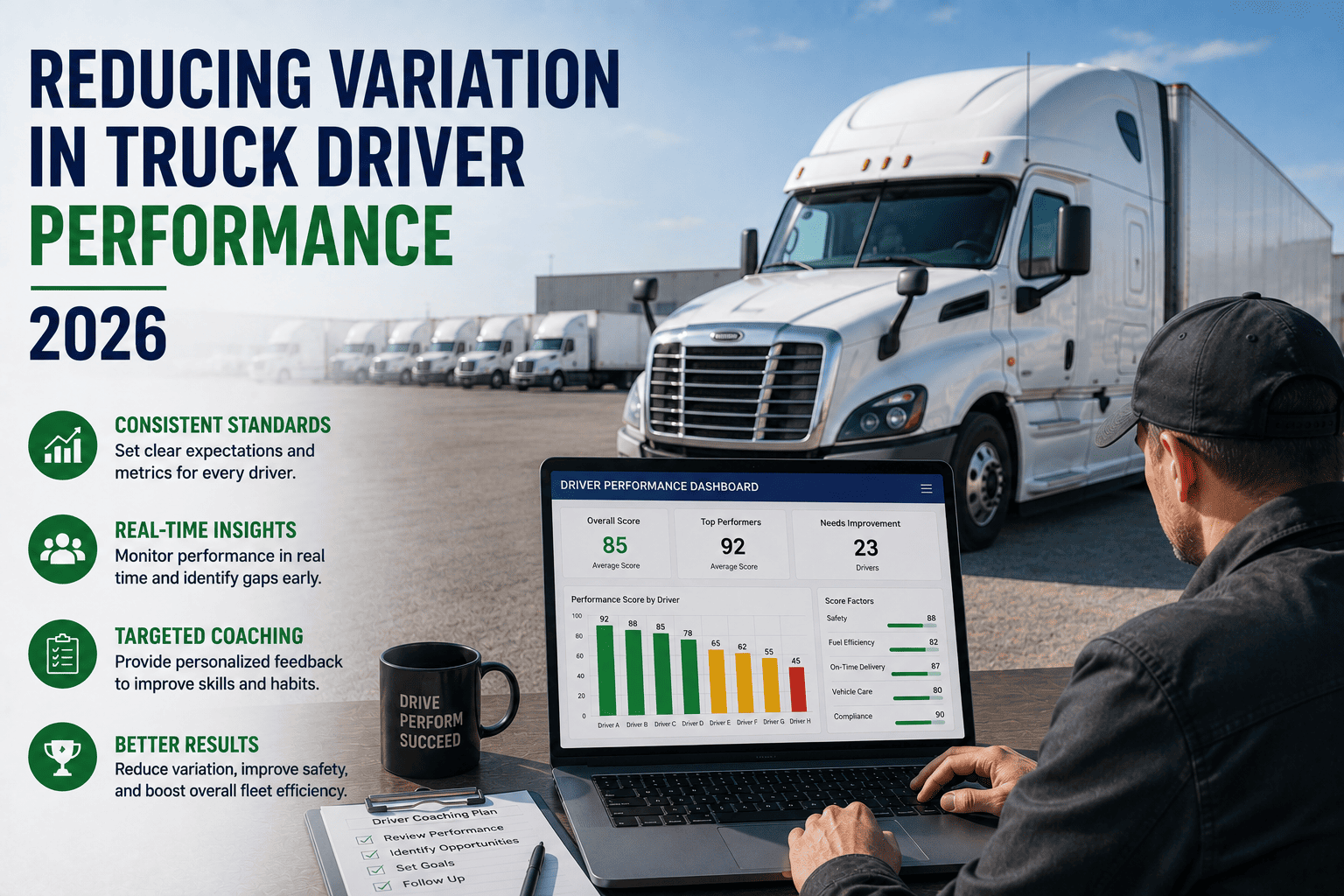
Real-time GPS tracking captures acceleration, braking, and speed data throughout each trip. The system flags excessive speeding, harsh acceleration, and abrupt braking events that correlate with accident risk. Safety dashboards show driver safety scores based on weighted aggressive driving metrics. Fleet managers can set fleet-wide speed limits and receive alerts when drivers exceed thresholds, enabling in-the-moment coaching via communication systems. Historical driver safety profiles support targeted safety training programs and informed decisions about driver retention or reassignment. Documentation of driver behavior patterns supports liability defense in accident investigations, demonstrating whether the fleet maintains a comprehensive safety monitoring program and holds drivers accountable for safe operation standards.
Idle Time and Fuel Consumption Analysis
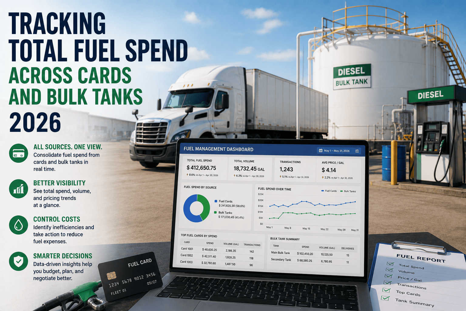
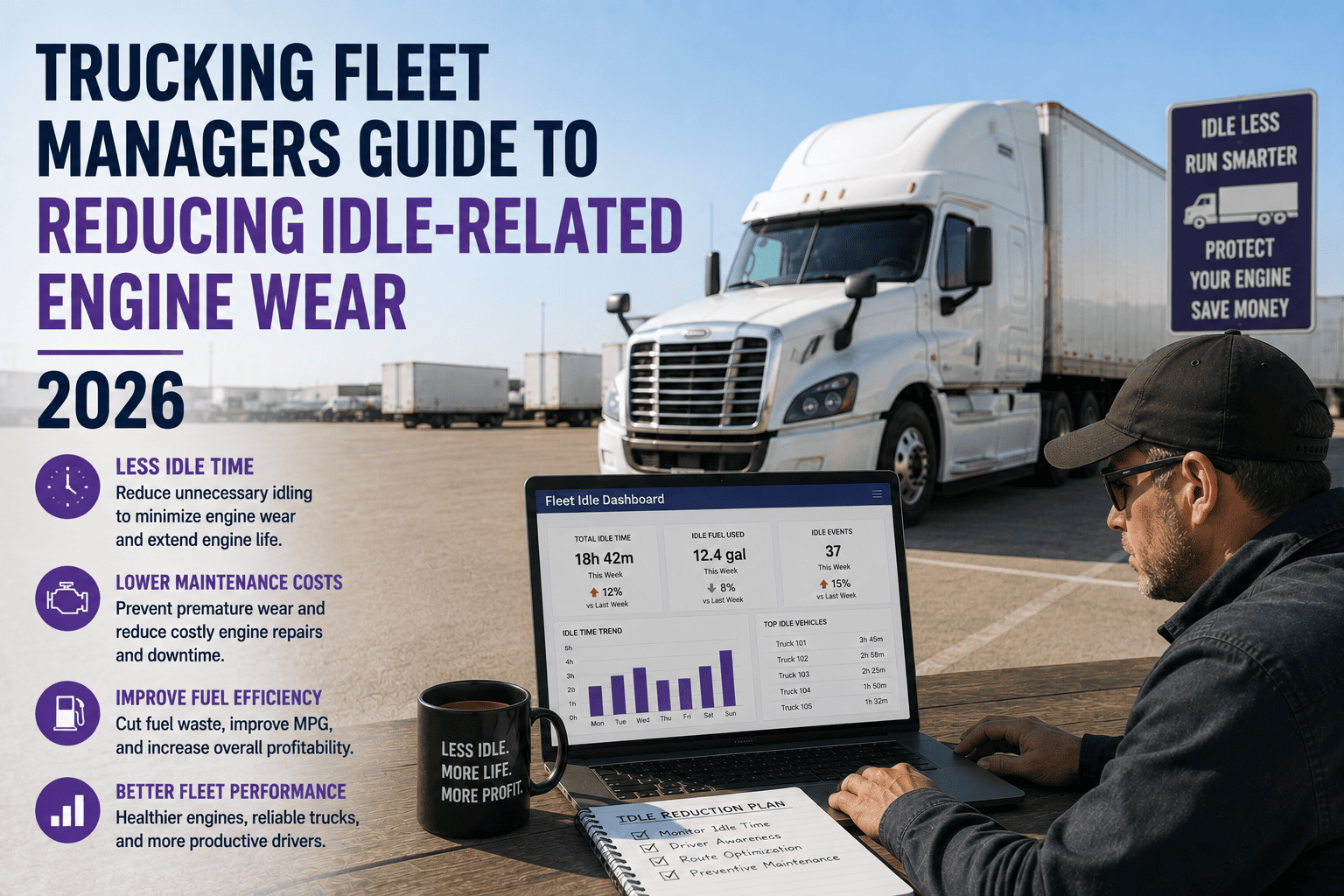
GPS data combined with engine runtime information identifies excessive idle time when vehicles are running but not moving. Idle time represents pure fuel waste without productive mileage. Fleet managers can set idle-time thresholds and receive alerts when vehicles exceed limits, supporting immediate driver intervention. Fuel consumption analysis compares actual fuel consumption against expected consumption based on mileage, cargo weight, and road conditions. Significant variances indicate theft, mechanical problems, or driver behavior issues. Fuel integration connects GPS idle data with fuel card transactions, revealing discrepancies that point to unauthorized refueling or fuel loss. Fleets typically identify 3-8% fuel waste from idle time and driver behavior, with real-time monitoring reducing waste within weeks as drivers recognize they are being monitored.
Proof of Service and Customer Confirmation
GPS tracking combined with mobile work order systems provides automatic proof of service documentation. When a driver marks a job as complete in the mobile app, the system captures the vehicle location, timestamp, and driver certification. Customers asking about arrival times see GPS-based arrival confirmation rather than vague ETAs. In delivery and service industries, GPS arrival documentation supports customer billing and dispute resolution. When customers claim deliveries were missed or late, fleet managers can review actual arrival times, dwell times at the location, and departure times from timestamped GPS records. This creates accountability for both drivers and customers, supporting transparent service delivery and reducing chargeback disputes.
Why Basic GPS Tracking Falls Short
- Single-purpose map apps show location but lack operational context and automated decision triggers
- Disconnected systems require managers to manually correlate location data with maintenance schedules and compliance records
- No integration with driver qualification files, HOS records, or safety programs means location data exists in isolation
- Lack of fuel consumption and idle-time tracking misses 30-40% of operational cost reduction opportunities
- No geofencing or route deviation capability means unauthorized stops and inefficient routing go undetected
- Separate driver behavior monitoring creates duplicate data collection and conflicting information sources
- No integration with work order systems means service appointments cannot be optimized based on vehicle location and availability
Real-Time GPS Tracking Use Cases for Transportation Companies
Different transportation and logistics business models require different GPS tracking capabilities. Understanding your specific use case helps identify which GPS features deliver the most value for your operation.
Last-Mile Delivery and Local Service
Delivery and local service fleets rely on GPS tracking to confirm customer pickup and delivery times, provide customers with real-time arrival windows, and optimize multi-stop routes to maximize stops per day. Route optimization algorithms use GPS data to suggest efficient sequences that minimize miles driven between stops. Geofencing around customer locations automatically confirms arrival and departure times. Driver mobile apps allow customers to track arriving deliveries in real time. Idle-time monitoring identifies inefficiencies between stops. For local fleets, GPS tracking typically delivers 15-25% productivity improvement through route optimization alone.
Long-Haul and OTR Operations
Over-the-road carriers use GPS tracking to monitor driver behavior during long driving days, ensure compliance with Hours of Service regulations, and identify rest areas and fuel stops. Real-time speed monitoring becomes critical on highways where aggressive driving creates significant liability risk. Geofencing around hazmat-restricted routes and border crossings ensures drivers follow required corridors. HOS integration with GPS tracking shows whether drivers are operating within regulatory limits and flags violations immediately. Long-haul operations also benefit from predictive maintenance alerts based on mileage accumulation visible through GPS odometer data.
Specialized Transport and Hazmat
Hazmat and specialized transport operations use GPS tracking for mandatory route compliance, restricted zone enforcement, and emergency response. Geofencing prevents vehicles from entering populated areas or school zones in violation of hazmat routing rules. Temperature-monitored trailers combine GPS location with cold-chain integrity monitoring, alerting when vehicles deviate from planned refrigerated routes or when temperatures drift outside specification. In emergency situations, GPS tracking provides real-time incident location to first responders. Regulatory agencies increasingly require GPS documentation for hazmat shipments, making real-time tracking a compliance requirement rather than optional.
Construction Equipment and Asset Tracking
Construction and heavy equipment fleets use GPS to track asset location across multiple job sites, prevent theft of expensive equipment, and monitor equipment utilization to identify underutilized assets. Geofencing around job sites ensures equipment remains within assigned locations and triggers alerts when equipment leaves a site outside normal working hours. Mobile asset tracking allows equipment managers to dispatch the nearest available asset to new jobs, reducing travel time and fuel costs. Idle-time monitoring on equipment reveals underutilization and supports decisions about equipment acquisition versus rental.
How FleetRabbit's GPS Tracking Integrates With Operations
GPS tracking in isolation creates information overload: managers see dots on a map but lack the context to make operational decisions. FleetRabbit's GPS module integrates real-time location data with maintenance schedules, compliance records, driver qualifications, and work order systems so location information automatically informs operational decisions.
GPS Data Triggers Maintenance Scheduling
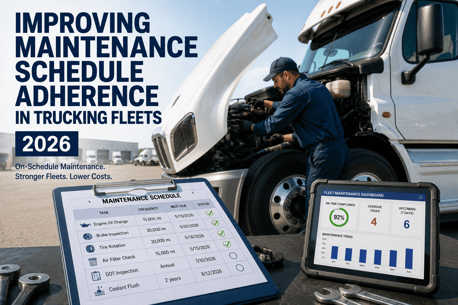
Preventive maintenance schedules often use mileage-based triggers. As vehicles accumulate miles through normal operation tracked by GPS, the system automatically identifies when vehicles approach their next scheduled service. When a vehicle reaches 90% of the mileage threshold for the next PM interval, the system generates a work order and can pre-position service appointments for when the vehicle is near the maintenance facility. Dispatch can plan routes that bring vehicles to maintenance facilities at the right time. This integration eliminates the manual tracking of mileage and prevents missed maintenance intervals that cause unexpected breakdowns.
Location Context for Dispatch and Route Optimization
Real-time vehicle location combined with work order queues enables dispatch systems to assign jobs to the nearest available vehicle, reducing travel time and fuel consumption. When new customer requests arrive, dispatch can see which vehicles are already in that geographic area and which can reach the location fastest. Route optimization uses GPS location data along with traffic conditions to suggest the most efficient sequence for completing multiple stops. Integration with ELD systems ensures dispatch does not assign loads that would cause drivers to exceed Hours of Service limits based on their current location and remaining driving time.
Driver Safety Integration
Speed and aggressive driving data flows from GPS monitoring into driver safety profiles. Safety dashboards identify drivers with elevated risk and support targeted coaching programs. When a driver is flagged for excessive speeding, dispatch can provide real-time coaching through in-vehicle communication systems. Safety metrics become part of driver performance evaluations and support informed decisions about driver retention and progression. For commercial auto insurance purposes, documented driver safety monitoring programs often qualify fleets for insurance premium reductions.
Compliance Documentation and Audit Support
FMCSA audits often examine whether fleets maintain accountability for vehicle operation and driver behavior. Real-time GPS tracking with documented speed monitoring, geofencing compliance, and idle-time management demonstrates to auditors that fleets actively monitor vehicle operation and intervene when drivers operate outside standards. GPS records provide historical documentation of whether vehicles stayed within Hours of Service operational windows and followed required routes. This comprehensive documentation supports safer operations and stronger positions during compliance reviews.
| Operation Type | Primary GPS Use Case | Key Integration Need | Typical ROI Timeline |
|---|---|---|---|
| Last-Mile Delivery | Route optimization, customer ETAs, stop confirmation | Work orders, dispatch, customer communication | 30-60 days |
| Long-Haul OTR | Driver behavior, HOS compliance, idle monitoring | ELD systems, HOS records, safety training | 60-90 days |
| Hazmat | Route compliance, restricted zone enforcement | Dispatch rules, compliance records | Immediate (compliance) |
| Equipment Transport | Asset theft prevention, utilization tracking | Geofencing, equipment records | 30-45 days |
| Multi-Stop Service | Dispatch efficiency, stop sequence optimization | Work orders, customer locations, traffic data | 30-60 days |
Common GPS Tracking Misconceptions and Reality Checks
GPS Tracking Means Micromanaging Drivers
Real-time GPS monitoring creates perception of employee surveillance in some driver populations. Implementing GPS tracking successfully requires clear communication about the program's purpose: reducing vehicle downtime, improving route efficiency, ensuring driver safety, and protecting customer assets. Fleets that frame GPS tracking as a safety and productivity tool rather than a surveillance mechanism experience better driver acceptance. Transparency about what data is collected, how it is used, and what triggers alerts helps drivers understand that monitoring supports their safety and the fleet's operational success.
GPS Tracking Solves All Operational Problems
GPS tracking provides visibility and enables better decision-making, but does not eliminate the need for operational discipline. Fleets still need solid maintenance programs, driver training, and dispatch processes to convert GPS data into operational improvement. GPS tracking without preventive maintenance is like having a thermometer but no heating system. Similarly, GPS visibility without dispatch process changes will not improve on-time delivery. GPS tracking is most valuable when it integrates with maintenance, compliance, safety, and dispatch functions as a connected system rather than as a standalone map.
Real-Time GPS Requires Constant Dashboard Monitoring
Modern GPS platforms use alerts and exceptions rather than requiring constant dashboard monitoring. Instead of watching a map continuously, managers set thresholds and receive alerts only when exceptions occur. Route deviation alerts trigger only when vehicles deviate outside configured tolerance. Speed alerts trigger only when drivers exceed thresholds. Idle alerts trigger only when idle time exceeds configured limits. This alert-driven approach means managers can focus on their core work and respond only when genuine exceptions occur rather than monitoring all vehicles all the time.
GPS Works Equally Well in All Environments
GPS performance varies in different environments. Signal loss occurs in dense urban environments, tunnels, underground parking structures, and heavily forested areas. Fleet managers operating in GPS-challenged environments benefit from systems that combine GPS with cellular triangulation or other backup location methods. Offline capability becomes important for fleets operating in areas with intermittent cellular coverage. Vehicle telematics integrating odometer and engine hour data can supplement GPS location data when satellites are unavailable. Understanding your specific operating environment helps ensure the GPS solution you select delivers reliable tracking in your conditions.
Measuring GPS Tracking ROI
Fleet managers evaluating GPS tracking investments need to calculate specific ROI for their operation rather than relying on generic benchmarks. While typical improvements range from 15-35% fuel cost reduction and 10-25% productivity improvement, your specific ROI depends on your current operational challenges and how you implement GPS tracking.
Fuel Cost Reduction
GPS idle-time and fuel consumption monitoring typically identifies 3-8% fuel waste in the first 30 days. Route optimization using GPS location data reduces miles driven by 5-15% depending on route complexity. Driver behavior coaching based on speed and acceleration monitoring typically reduces fuel consumption another 2-5%. For a fleet spending $200,000 annually on fuel, 3-8% reduction equals $6,000-$16,000 in annual savings. This is often sufficient to justify GPS tracking investment within months.
Productivity and On-Time Delivery Improvement
Fleets using GPS-optimized dispatch and route sequencing typically improve stops-per-day by 10-20% for multi-stop operations. For service and delivery fleets, this productivity improvement translates directly to revenue growth without proportional cost increase. If a fleet completes 15% more jobs per day with the same vehicle and driver count, revenue increases materially. On-time delivery improvement resulting from better dispatch and route planning reduces customer chargeback claims and supports customer retention and satisfaction.
Maintenance Cost Savings
GPS-triggered preventive maintenance scheduling prevents breakdown-related emergency repairs that cost 2-3 times more than planned maintenance. Identifying vehicles approaching maintenance intervals before breakdowns occur keeps vehicles available for revenue-generating work. For fleets with critical service-level agreements, preventing even one major breakdown that causes service interruption justifies GPS tracking investment.
Insurance and Liability Reduction
Commercial auto insurance carriers often offer 3-10% premium reductions for fleets maintaining documented driver behavior monitoring programs. Documented safety monitoring programs also support more favorable outcomes in accident litigation by demonstrating the fleet maintains proactive safety oversight. For a fleet with $100,000 annual commercial auto insurance costs, even a 5% premium reduction equals $5,000 in annual savings.
See Your Fleet in Real Time With Complete Context
FleetRabbit's GPS tracking module connects live vehicle location with maintenance schedules, compliance records, and driver behavior data so every decision is made with complete operational visibility.
Frequently Asked Questions: Real-Time GPS Fleet Tracking
Q: How accurate is GPS tracking for fleet vehicles?
Modern GPS tracking accuracy is typically 5-15 meters under open sky conditions. Urban canyons and dense foliage reduce accuracy but integrated telematics compensates. FleetRabbit combines GPS with odometer data for mileage-based calculations, ensuring reliable PM scheduling and fuel consumption analysis regardless of GPS accuracy variations.
Q: Does GPS tracking work when vehicles lose cellular signal?
Modern systems store location data locally when signal is lost and sync to the cloud when connectivity returns. This allows complete tracking history even in areas with intermittent coverage. GPS satellites are separate from cellular networks, so location continues being recorded even when cell signal drops.
Q: Can drivers disable GPS tracking on their vehicles?
Hardware-based GPS devices cannot be disabled by drivers once installed. Drivers cannot disconnect fleet-issued telematics hardware without obvious evidence. Software-only approaches allow driver interference, which is why enterprise fleets typically deploy hardware-based solutions for reliable monitoring.
Q: How does GPS integration with maintenance scheduling work?
FleetRabbit tracks vehicle mileage from GPS and odometer data. When a vehicle reaches 90% of mileage toward the next PM interval, the system automatically creates a work order. Start your free trial to see mileage-based scheduling in action or book a demo for a personalized walkthrough.
Q: What geofencing capabilities does FleetRabbit offer?
FleetRabbit supports unlimited custom geofences around customer locations, service territories, restricted zones, and geographic regions. Configure geofence radius, entry/exit alerts, and alert recipients. Geofence data integrates with work orders for automatic delivery confirmation when vehicles enter customer locations.
Q: How does GPS tracking improve driver safety?
GPS captures speed, acceleration, and braking patterns that correlate with accident risk. FleetRabbit flags aggressive driving and feeds data into driver safety profiles. Coaches use this data for targeted interventions. Many insurance companies offer 3-10% premium reductions for fleets with documented monitoring programs.
Q: Does FleetRabbit integrate GPS data with my dispatch system?
FleetRabbit's dispatch module uses real-time GPS location to assign jobs to nearest available vehicles. Route optimization algorithms use location data to suggest efficient stop sequences. This integration ensures dispatch decisions account for actual vehicle positions and fuel consumption impact.
Q: How can I measure GPS tracking ROI for my fleet?
Start by tracking current fuel consumption, idle time, miles per stop, and on-time delivery percentage. After GPS implementation, measure the same metrics monthly. Most fleets see 3-8% fuel reduction within 30 days. Book a demo to discuss expected ROI for your specific operation or start a free trial to measure baseline metrics.
Q: What reports and dashboards does FleetRabbit provide?
Real-time dashboards show vehicle location, speed, idle time, and driver behavior. Historical reports show fuel consumption by vehicle and driver, route efficiency metrics, and driver safety scores. Customizable views let managers focus on metrics most relevant to their role. One-click export generates compliance and audit reports with custom date ranges.
Transform GPS Tracking From Visibility to Intelligence
FleetRabbit's integrated GPS tracking gives transportation companies real-time visibility connected to maintenance, compliance, and safety systems so every data point drives operational improvement.